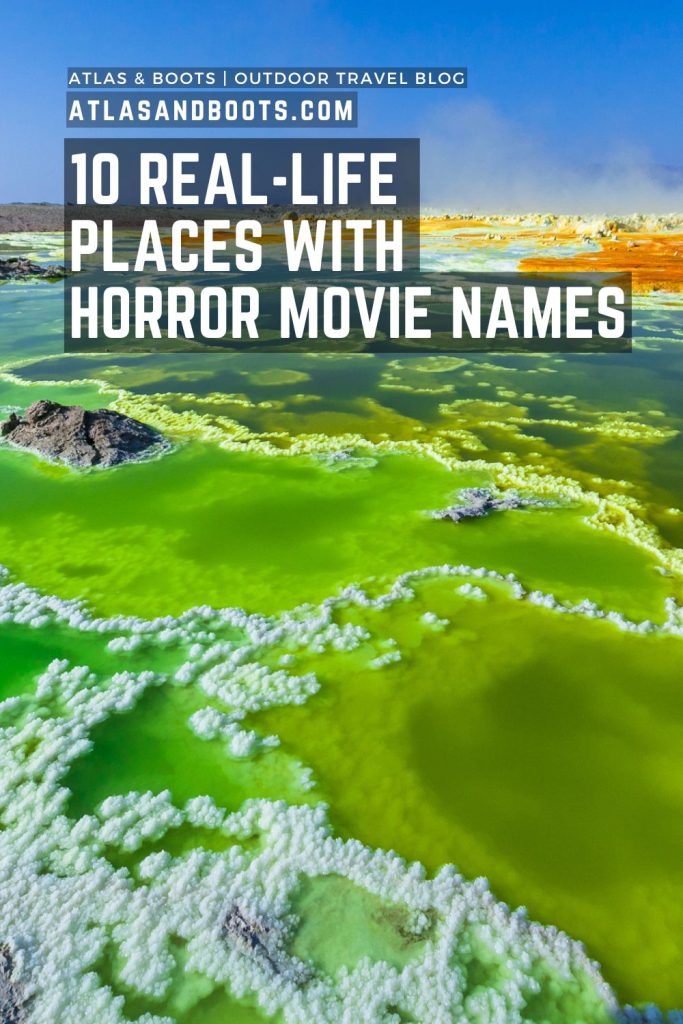
From creepy peaks to death and depression, we venture into eerie real-life places with horror movie names
Picture this: you’re driving along a sun-scorched plain in the Australian Outback. You’re thirsty, sweaty, irritable and in desperate need of a wash. As you and your friend quibble about whether you should have stopped at that tiny shack of a motel 30 kilometres ago, you spot a sign up ahead. According to the map, you’re hours away from the next stop. Might this be a reprieve?
You slow the car to a stop.
The rusted metal sign shows a faded arrow pointing further inland, but there’s no discernible path. A handwritten scrawl spells out two words: “Wolf Creek”.
Are you following the arrow?
The correct answer, of course, is hell no. Even the casual viewer will know that this is horror film 101. Don’t follow signs to a place that sounds creepy AF.
On our travels, we at Atlas & Boots have come across several places with eerie names; places you would avoid on a long drive through quiet plains. Below, we explore 10 real-life places with horror movie names.
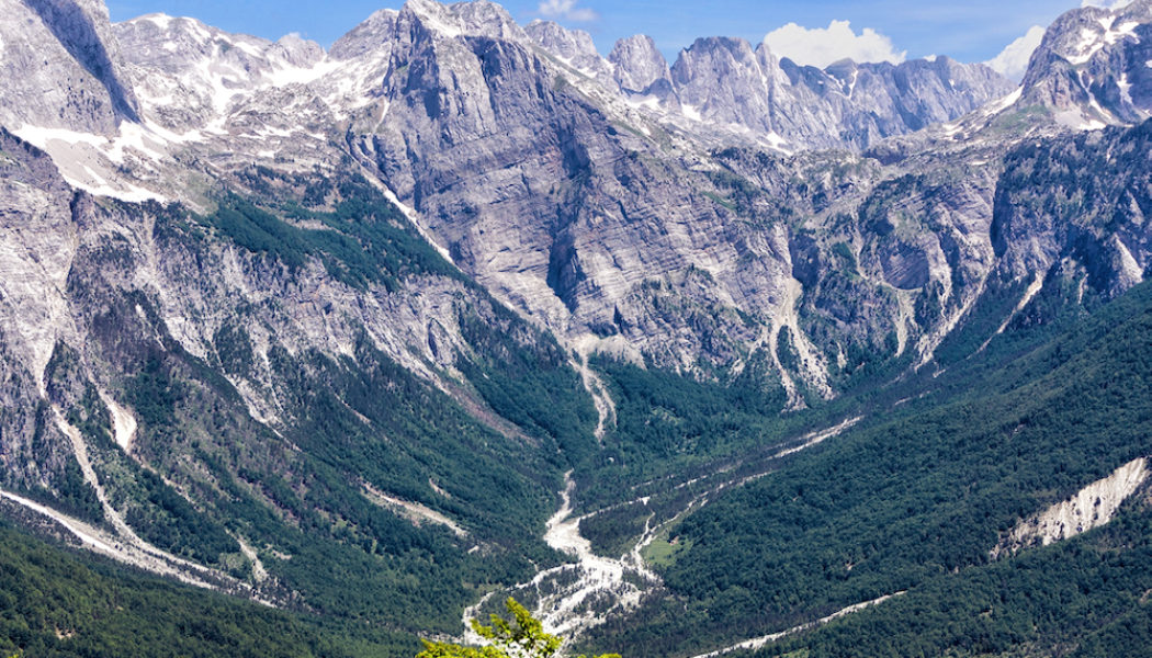
1. Accursed Mountains
As legend has it, God took six days to create heaven, earth and the sea but it took the devil only 24 hours to create the Accursed Mountains. Here, sweeping ravines cut deep into the landscape while razor-like spires of rock reach jealously towards the heavens.
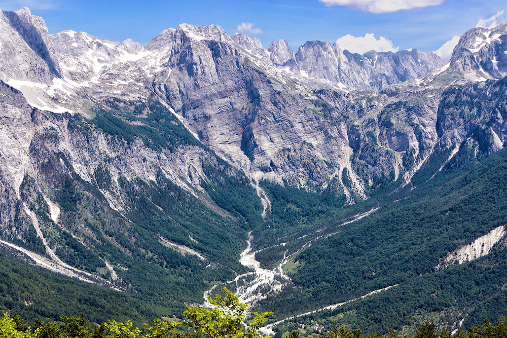
Located in northernmost Albania, the Accursed Mountains stretch more than 60 kilometres (40 mi), straddling the border with Montenegro and Kosovo.
It is said that the curse on the range lasted long beyond creation as bandits, blood feuds, landslides and avalanches have historically made the region a treacherous place to visit.
Today, it remains remote but is becoming more popular with adventurous hikers, earning it the slightly less scary moniker of the Albanian Alps.
2. Apocalypse Peaks
Victoria Land in Antarctica borders the western side of the Ross Ice Shelf, extending into the sea itself. Here, between two iceless valleys lie the Apocalypse Peaks.
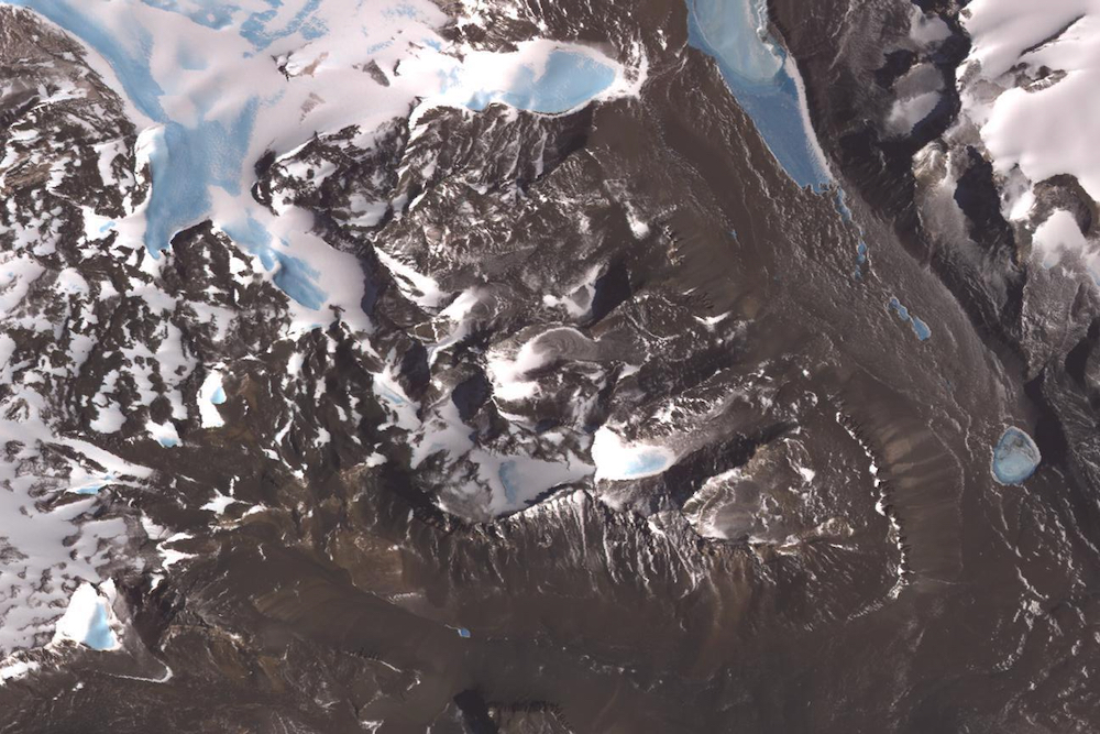
In 1958-59, explorers from the Victoria University of Wellington Antarctic Expedition noticed that the peaks resembled the four horsemen of the Apocalypse, and gave them the foreboding name.
The peaks’ highest point stands at 2,360 metres (7,740 ft), less than half the height of Mount Vinson at 4,892 meters (16,050 ft), the tallest peak in Antarctica and one of the seven summits coveted by mountaineers.
3. Death Valley
Death Valley in California is one of the hottest places on earth. In 1913, the United States Weather Bureau recorded a temperature of 56.7°C (134°F) at Furnace Creek which, if accurate, would be the highest ambient air temperature ever recorded on the surface of the earth.
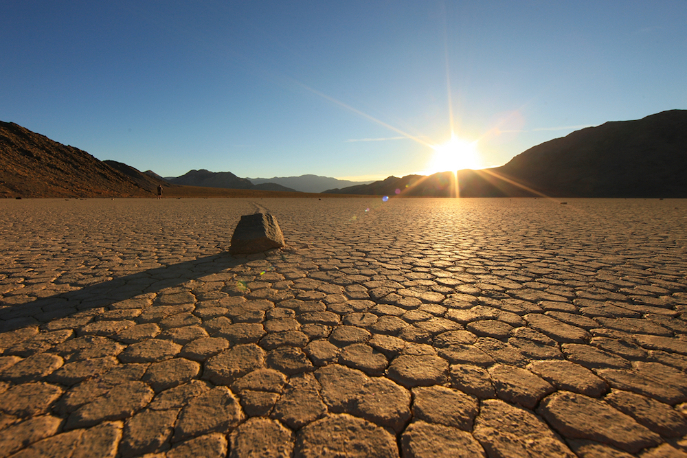
Here, a parched landscape of sand dunes and salt pans create a hellish heat. The area is so dry because there are four mountain ranges between Death Valley and the ocean, creating an ever-drier “rain shadow” effect.
The driest stretch on record was a 40-month period from 1931 to 1934 where only 1.6cm (0.64 inches) of rain was recorded. Some years, like 1929 and 1953, there was no rain at all.
5. Skeleton Coast
The Skeleton Coast in Namibia is so named for the bleached whalebones that once dotted its shore, later replaced by the rusting hulls of more than a thousand shipwrecks.
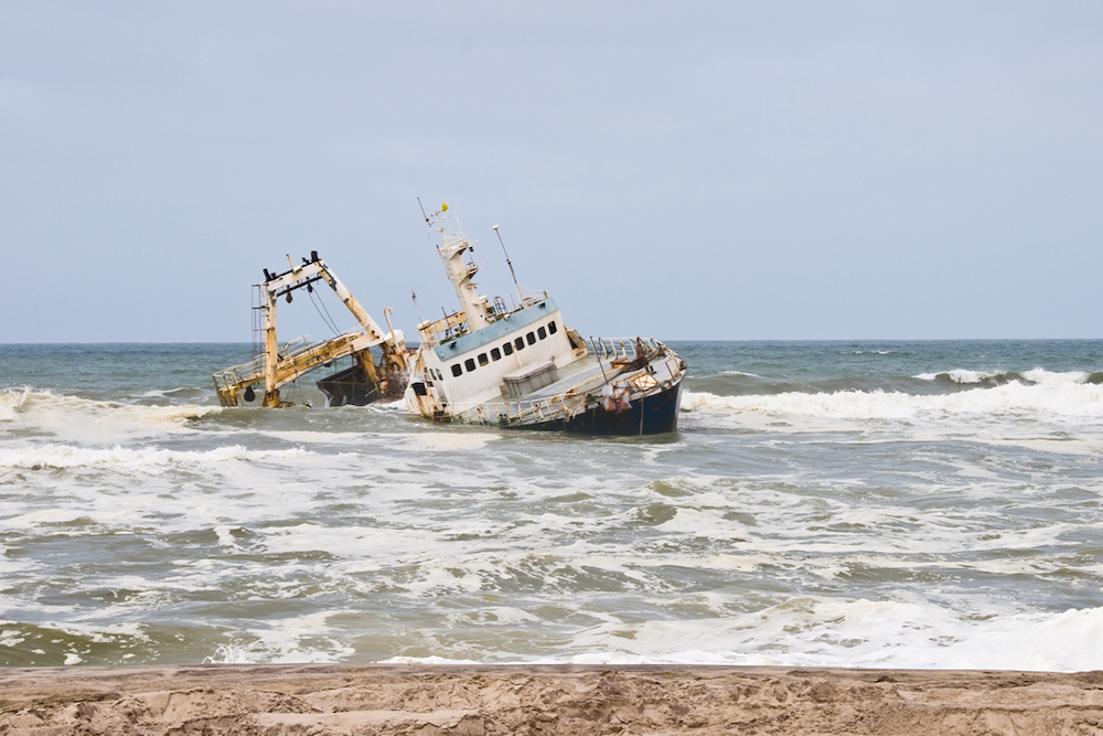
Sadly, the most impressive victims of this infamous coast have been swallowed by sand and sea, but there still remains a stark beauty well worth exploring.
Here, dunes roll to the sea while vast stretches of desert-scape are misted by the tendrils of coastal fog. Shipwrecks can still be found along the shore, the easiest of which to reach is the Zeila, 14km south of Henties Bay.
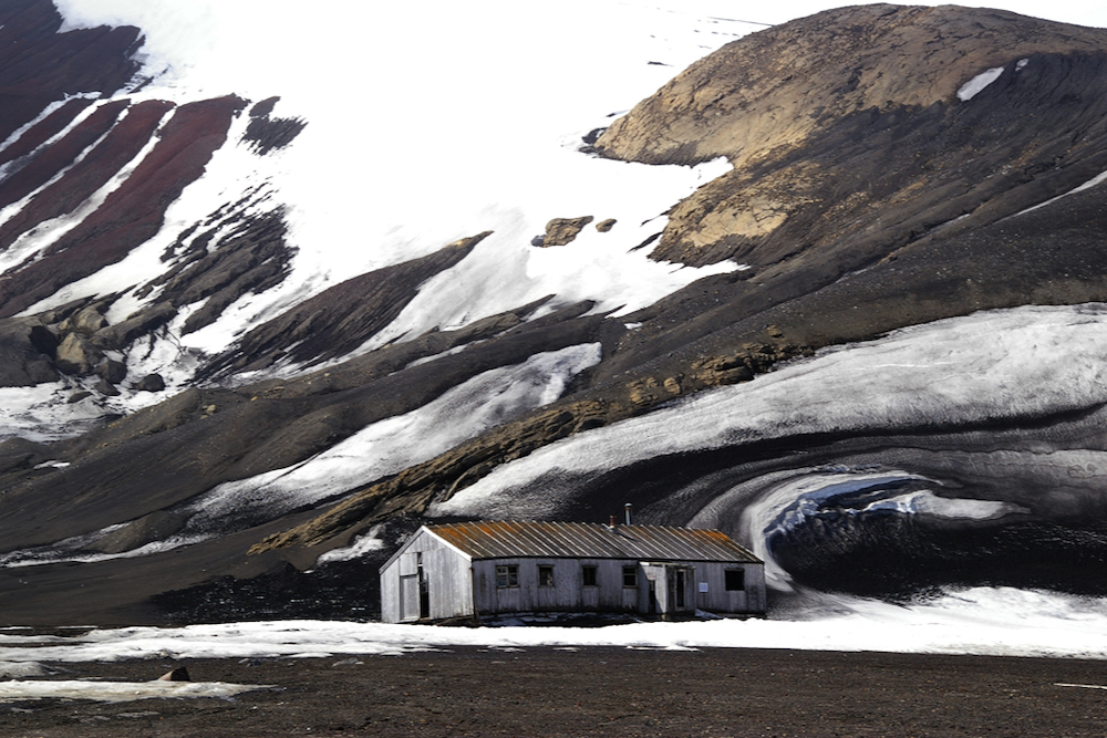
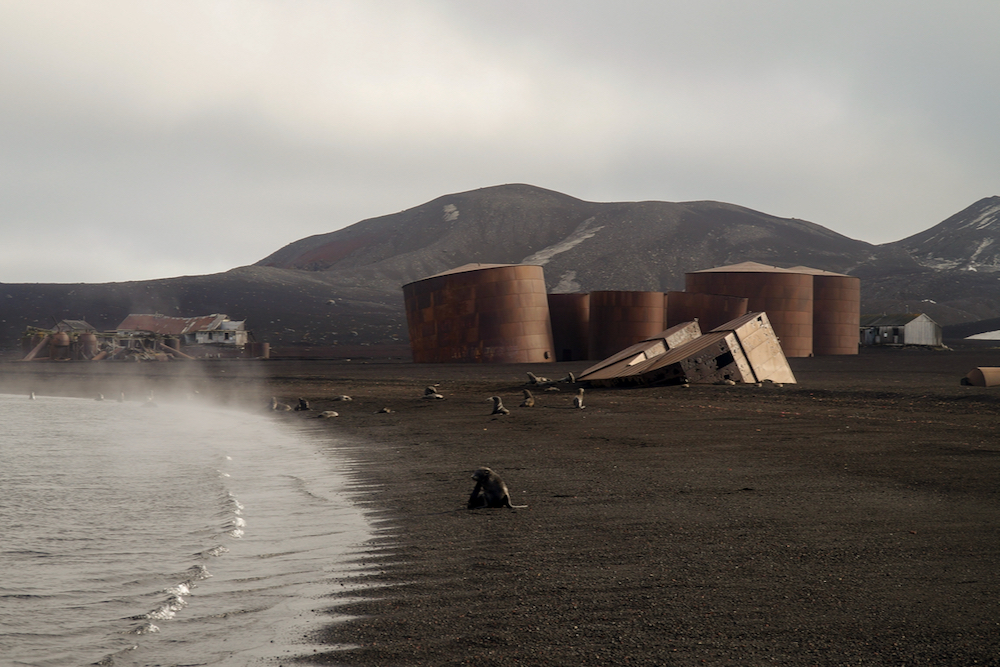
6. Deception Island
Deception Island truly looks like the scene of a horror movie. Located in the remote South Shetland Islands, it is formed from the caldera of an active volcano which seriously damaged Antarctic research stations in 1967 and 1969.
Dreamstime
Deception Island
The island was once a whaling station and the rusting ruins of giant blubber tanks form an eerie scene.
Today, the island is a tourist destination with over 15,000 visitors annually. In the summer, it is used as a research base by Spain and Argentina.
Several countries have asserted sovereignty over the island but it remains under the Antarctic Treaty System, meaning no single country has control.
7. Desolation Sound
Desolation Sound is a deep water sound in remote British Columbia, Canada. Long inhabited by First Nations tribes, it was first mapped in 1792 by two expeditions led by Captains George Vancouver, Dionisio Alcalá Galiano and Cayetano Valdés y Flores.
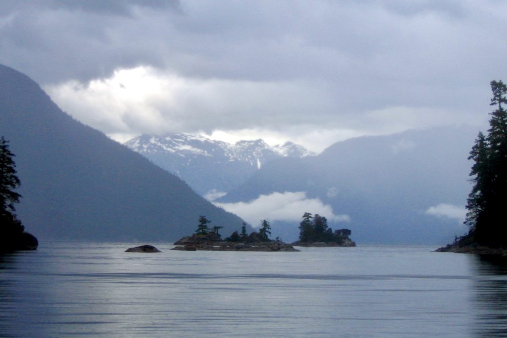
Vancouver claimed “there was not a single prospect that was pleasing to the eye” and hence named the area Desolation Sound.
Surrounded by steep evergreen mountains, the sound remains remote even today. The closest road is 20 miles south, where the Pan American Highway ends in the tiny village of Lund (population: 292). As such, the desolate sound can only be reached by water.
8. The Door to Hell
In 1971, while drilling in the gas-rich area of Derweze in Turkmenistan, Soviet geologists cut into a cavern filled with natural gas. The ground beneath the rig collapsed, leaving a crater of approximately 70 metres in diameter.
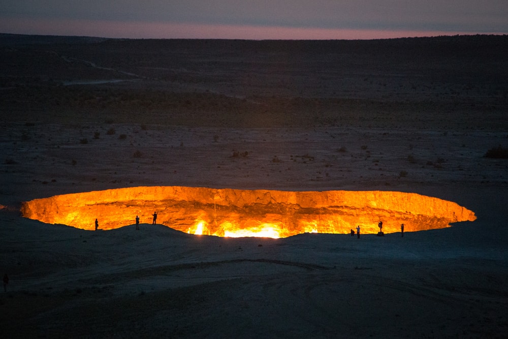
Experts decided to burn off the gas to avoid poisonous discharge. They lit a fire expecting the fuel to be consumed in a matter of days.
More than 50 years later, the ‘door to hell’ is still burning.
9. Devil’s Pool
Africa’s Victoria Falls is neither the highest nor widest waterfall in the world, but it is classed as the largest based on its combined height and width, making it the world’s largest sheet of falling water.
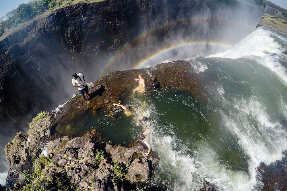
Zimbabwe offers more panoramic viewpoints, but Zambia offers the chance to swim in the famous Devil’s Pool.
This much-photographed spot at the lip of the falls allows adventurous swimmers to take a dip mere feet from the point where the water cascades over the falls.
10. Mount Erebus
In Greek mythology, ‘Erebus’ is the personification of darkness. It refers to the darkness of the underworld, the underworld itself or the region through which souls pass to reach the underworld.
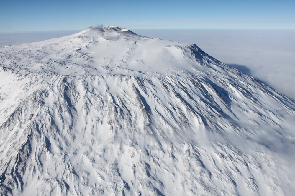
Mount Erebus, named by Captain James Clark Ross in 1841 after his ship, is the southernmost of the world’s active volcanoes. Located on Ross Island in Antarctica, it has a summit elevation of 3,794m (12,448ft) and is home to one of the world’s few persistent lava lakes.
Erebus is remarkable because its low-level but persistent activity allows volcanologists to study the Strombolian eruptive system very close to the active vents (hundreds of metres).
Erebus is also notable for its fumaroles: vents in the Earth’s crust which allow steam and gases to escape from volcanoes. As soon as the steam leaves one of these vents, it freezes, eventually forming massive snow chimneys.
Enjoyed this post? pin it for later…