From the rocky headlands of Acadia to the sandstone cliffs of Zion, we share the best hike in every US national park
America’s 63 national parks offer an encyclopaedic array of natural sights – from trees that existed at the time of dinosaurs to fiercely active volcanos. That’s before we even get into the hundreds of other units such as national monuments, historic sites, preserves, reserves, rivers, parkways and recreation areas.
At last count, America’s public lands received nearly 300 million recreational visits a year and for good reason. The country’s national park system is a model that has been replicated the world over.
With so much variety within the millions of acres of outdoor space, it’s difficult to know where to start. To point the way, we’ve put together a list of the best hike in every US national park so you can get the most out of your walk in the woods.
Best hike in every US national park
We have drawn on personal experience, expert recommendations from the National Park Service and crowdsourcing via AllTrails – one of the world’s most popular hiking apps – to create our curated list of the best hike in every US national park.
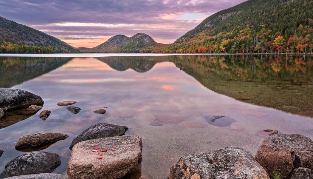
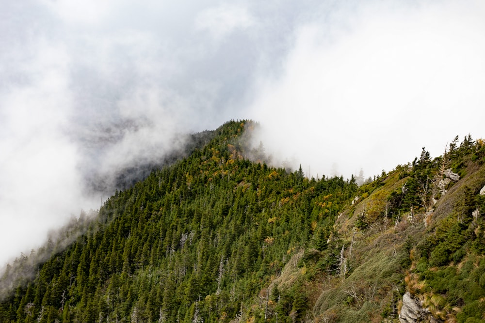
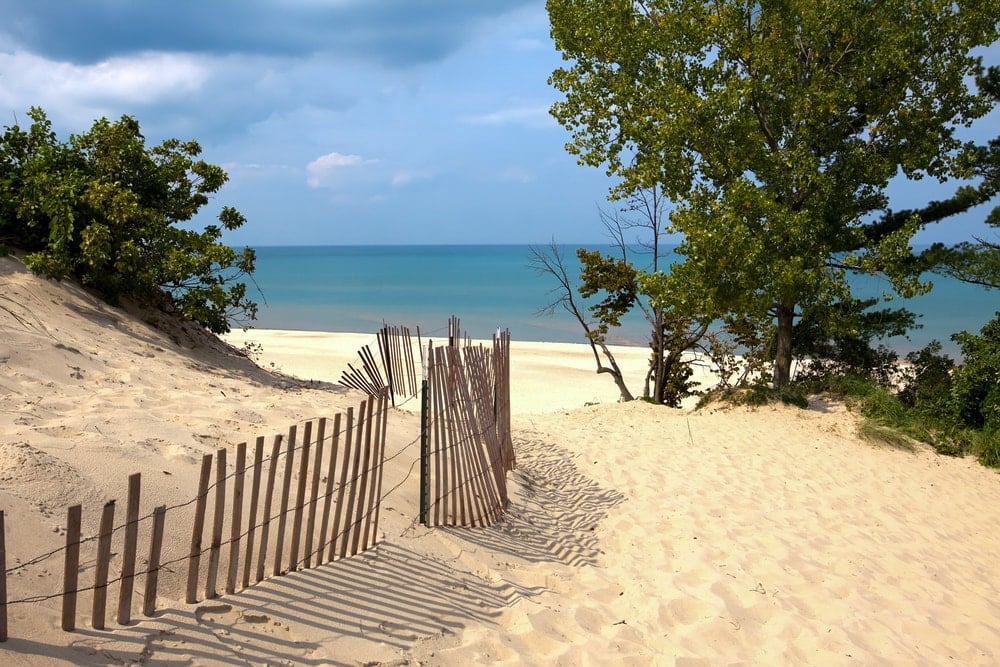
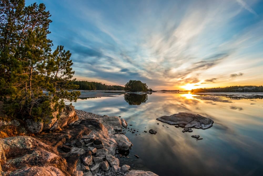
1. Acadia National Park
State: Maine
Hike: Jordan Pond, Sargent Mountain and Penobscot Mountain Loop
Distance: 9km
Duration: 2-3 hours
Difficulty: Moderate
More info
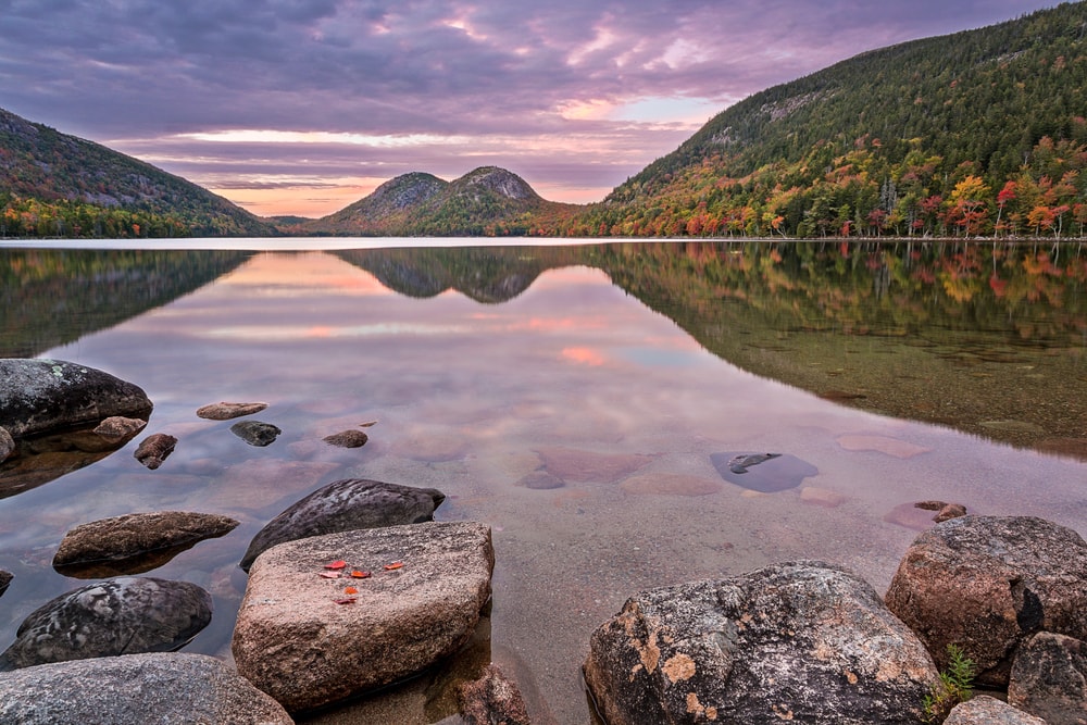
New England’s only national park, Acadia is known for its rocky Atlantic headlands, dense hardwood forest and 250km (158mi) of hiking trails. Set back from the coast is the idyllic Jordan Pond surrounded by thick woods that turn vermillion in the autumn. Be aware that as one of America’s 10 busiest parks, Acadia has introduced a timed reservation system for visitors to the popular Cadillac Summit Road.
2. Arches National Park
State: Utah
Hike: Devils Garden Loop
Distance: 12.7km
Duration: 3-4 hours
Difficulty: Moderate
More info
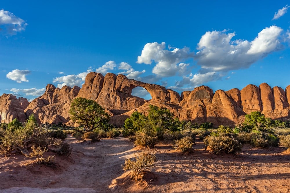
Known for its 2,000 natural sandstone arches, snow-capped peaks and desert landscapes, Arches National Park has to be seen to be believed. The park was recently hit the headlines when it was forced to regularly close its gates by 8am as car parks and trails maxed out their capacities. Some days the gates stayed closed for five hours before reopening. As such, it has introduced a site-wide timed-entry system for all visitors. Devil’s Garden Trailhead is popular but does manage to escape some of the crowds the further in you get.
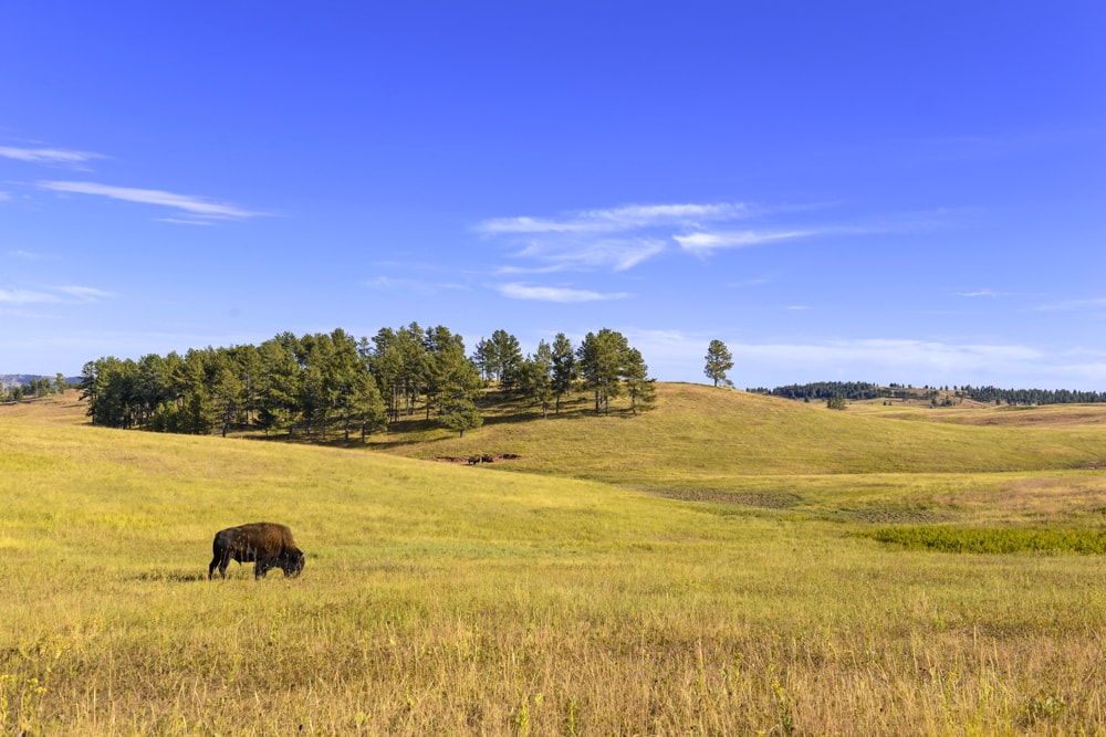
3. Badlands National Park
State: South Dakota
Hike: Notch Trail
Distance: 2.4km
Duration: 1 hour
Difficulty: Easy
More info
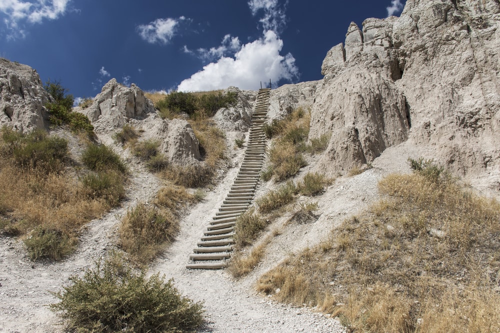
Badlands takes its name from the Lakota term mako sica (badland). Once you gain a bit of height and look across the barren-looking rainbow-hued gullies and ridges, you can see why. But explore a little further and you’ll see that the park is teeming with wildlife including bison, bighorn sheep, prairie dogs and black-footed ferrets.
4. Big Bend National Park
State: Texas
Hike: Lost Mine Trail
Distance: 7.7km
Duration: 2-3 hours
Difficulty: Moderate
More info
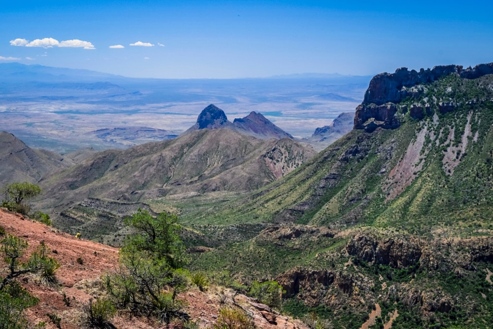
The Chisos Mountains in Big Bend National Park in Texas are known for their deep canyons, big skies and ancient limestone cliffs. This out-and-back trail showcases the best of the park and boasts far-reaching cross-border views of the Sierra del Carmen mountains in Mexico.
5. Biscayne National Park
State: Florida
Hike: Spite Highway to Hidden Beach
Distance: 9km
Duration: 1-2 hours
Difficulty: Easy
More info
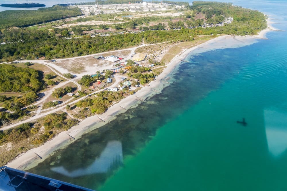
A significant chunk of the world’s third-largest reef system sits in the waters off the coast of Florida. While you won’t see much of the colourful coral from the park’s only hiking trail, you will find tropical forests, sandy beaches and aquamarine waters along this return hike near Cutler Bay.
6. Black Canyon of the Gunnison National Park
State: Colorado
Hike: Exclamation Point
Distance: 4.7km
Duration: 1-2 hours
Difficulty: Easy
More info
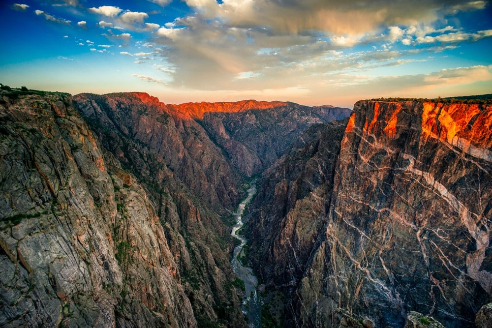
The Gunnison River has carved a yawning tear in the volcanic rock of Colorado over the course of two million years. The sight is nothing short of breathtaking and is best viewed from the ever-popular trail to Exclamation Point. The scene is at its most spectacular at sunset – but don’t expect to have the viewpoint to yourself.
7. Bryce Canyon National Park
State: Utah
Hike: Under the Rim Trail
Distance: 36km
Duration: 10-12 hours
Difficulty: Hard
More info
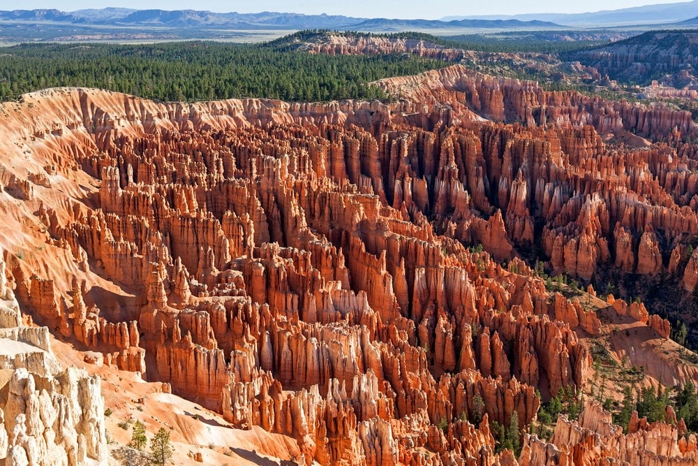
Bryce Canyon is one of the more otherworldly US national parks. Interestingly, it is not technically a canyon as it was not formed by erosion from a central stream. Instead, erosion spread out from the origin of a stream channel and created large amphitheatres featuring delicate pinnacles up to 200ft (60m) in height.
These pinnacles, called ‘hoodoos’, can be found on every continent, but Bryce boasts the largest collection in the world. Sunrise and sunset are ideal times to observe this extraordinary landscape.
Alternative: Peekaboo Loop Trail, 8.4km, 3-4 hours
8. Canyonlands National Park
State: Utah
Hike: Grand View Point
Distance: 2.9km
Duration: 1 hour
Difficulty: Easy
More info
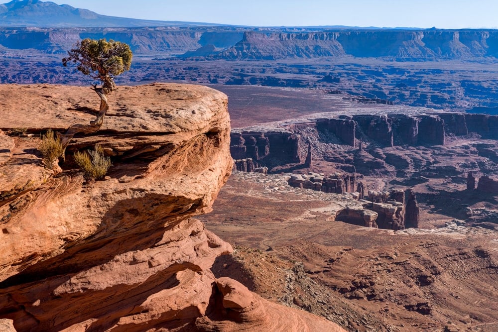
Canyonlands National Park offers a wilderness of canyons and fantastically formed buttes carved by the mighty Colorado River and its tributaries. This short but sweet hike to Grand View Point provides a pocket slideshow of the best the park has to offer including myriad basins, scores of canyons and the La Sal Mountains on the horizon.
9. Capitol Reef National Park
State: Utah
Hike: Halls Creek Narrows
Distance: 37.2km
Duration: 8-10 hours
Difficulty: Hard
More info
You’ll need a compass for this overnight hike along an unmarked route through the slot canyon of Halls Creek Narrow. You’ll wend your way between the towering cliffs which are regularly compared to the infamous Narrows of Zion. However, this craggy circular trail is considerably more rugged and remote.
Alternative: Grand Wash, 8km, 1-2 hours
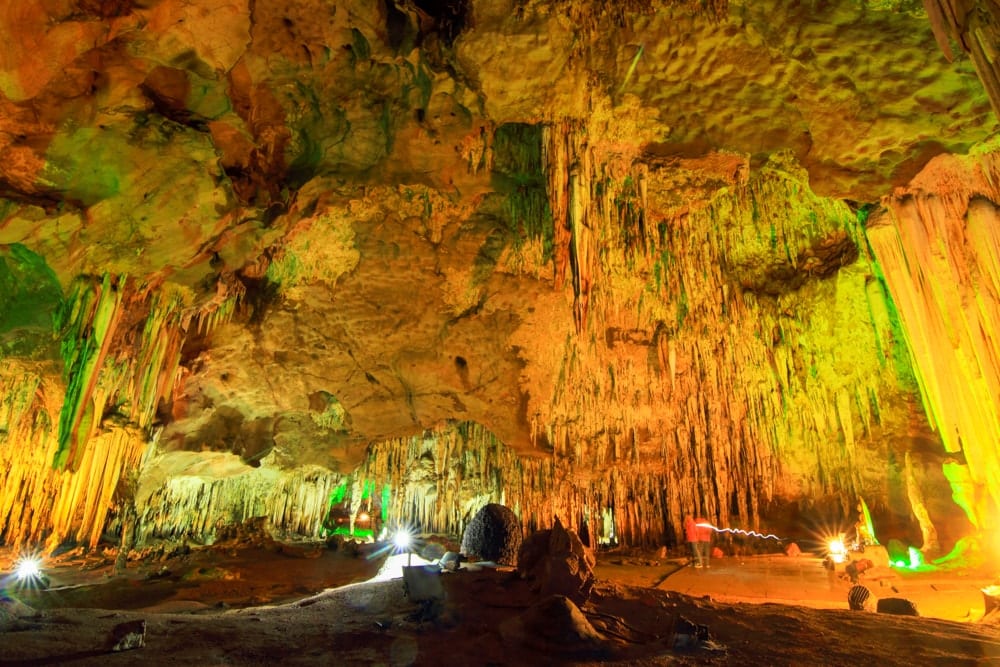
10. Carlsbad Caverns National Park
State: New Mexico
Hike: Big Room Trail
Distance: 2km
Duration: 1-2 hours
Difficulty: Easy
More info

Ancient sea ledges, deep rocky canyons, flowering cacti and desert wildlife all thrive in the Chihuahuan Desert. Hidden in its northern reaches, however, beneath the Guadalupe Mountains, lies one of the deepest and largest caverns ever found.
Featuring a range of extraordinary rock and reef formations, Carlsbad Cavern is home to the Big Room, a natural limestone chamber that is almost 4,000ft (1,220m) long, 625ft (190m) wide, and 255ft (80m) high at the highest point.
One of its most spectacular sights can be seen at the mouth of the cave where more than a quarter-million bats congregate in the summer. At sunset, they spiral up in a mighty exodus as they search for food – but don’t worry, they don’t eat humans.
11. Channel Islands National Park
State: California
Hike: Lobo Canyon Trail
Distance: 7.7km
Duration: 1-2 hours
Difficulty: Easy
More info
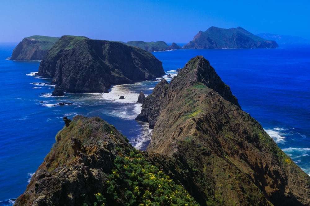
Channel Islands National Park comprises five extraordinary islands rearing up from the Pacific Ocean. Their isolation over thousands of years of separation from the mainland has created flora, fauna and archaeology found nowhere else on the planet and earned them the nickname ‘California’s Galápagos’.
This out-and-back hike weaves through grassland bluffs with sweeping views of the ocean before dropping into a canyon sheltering several of the islands’ 50 endemic species of plants and animals.
12. Congaree National Park
State: South Carolina
Hike: River Trail
Distance: 15.9 km
Duration: 2-3 hours
Difficulty: Easy
More info
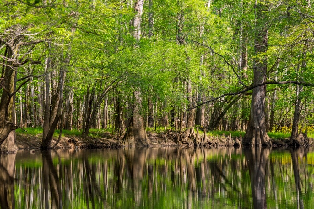
Spread across nearly 27,000 acres, Congaree National Park is the largest intact stretch of old-growth bottomland hardwood forest in the southeastern US. The dense trees found here are among the tallest in the eastern US and form one of the highest temperate deciduous forest canopies remaining on Earth.
As most of the park lies within a floodplain, the terrain is generally very flat with boardwalks regularly used. Don’t be surprised to spot an alligator or two along this circular trail near St. Matthews.
13. Crater Lake National Park
State: Oregon
Hike: Watchman Peak Trail
Distance: 2.7km
Duration: 1 hour
Difficulty: Easy
More info
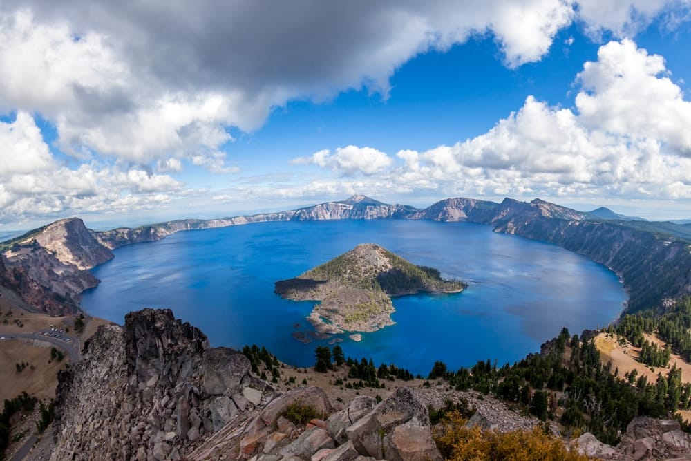
Crater Lake may be one of the lesser-known US national parks but it boasts an incredible centrepiece nonetheless. Its eponymous caldera lake is the deepest lake in the US. At 1,943ft (590m) deep, it is about six times the height of the Statue of Liberty.
There are no rivers flowing into or out of the lake but rain and snowfall compensate for evaporation at a rate that replaces the total body of water every 250 years.
Another fascinating fact comes from the ‘Old Man of the Lake’, a full-sized tree that is now a stump that has been bobbing in the lake for over a century. Its decomposition is so slow because of the water’s low temperature.
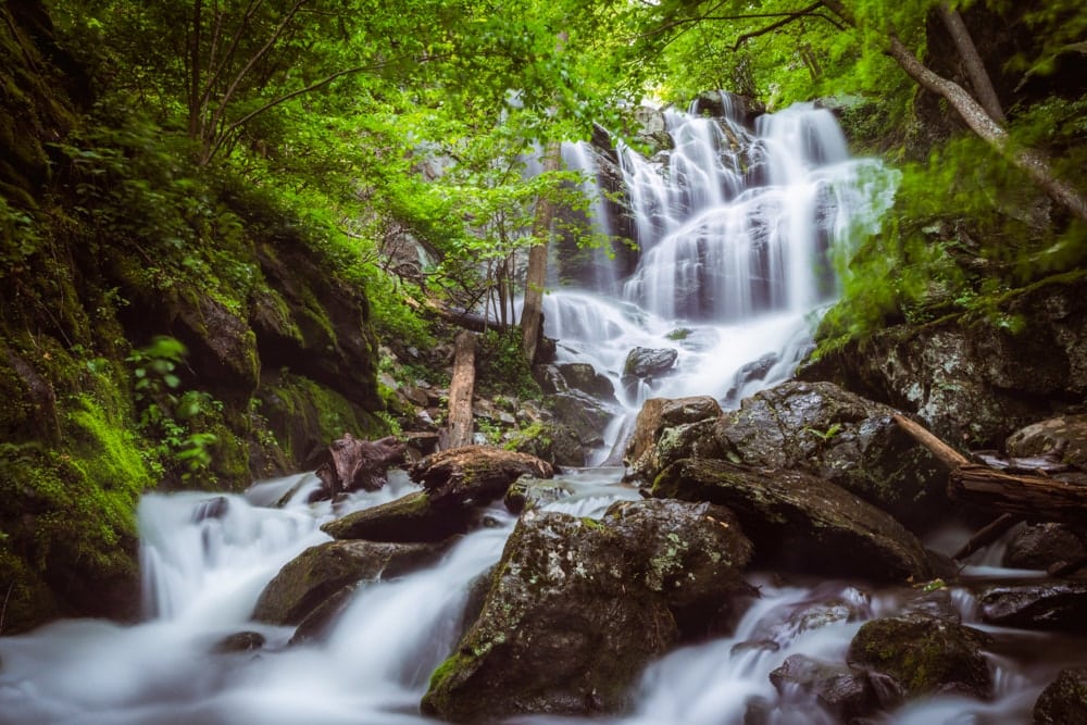
14. Cuyahoga Valley National Park
State: Ohio
Hike: Brandywine Gorge Trail
Distance: 2.3km
Duration: 1-2 hours
Difficulty: Easy
More info
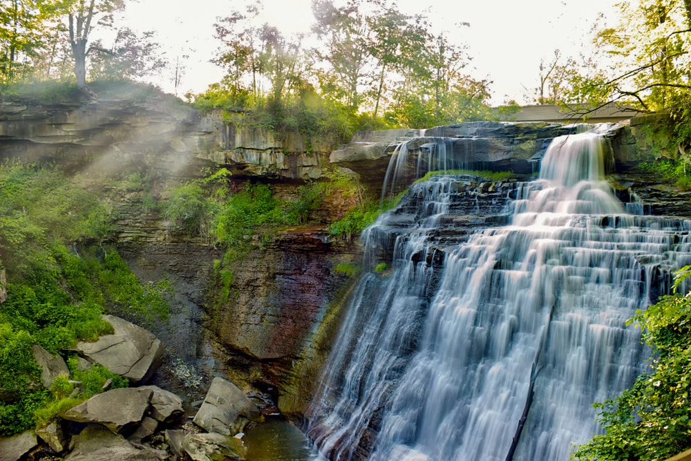
This circular trail near Hudson explores the rare rocky ledges and thundering waterfalls that feel a world away from surrounding flat, rural Ohio. This easy-to-navigate trail begins at the 20m-high Brandywine Falls before it rambles along a looping track that passes a vintage 19th-century lodge before dropping down to an idyllic gurgling brook. Brandywine Gorge is at its best when the autumnal colours are out.
15. Death Valley National Park
State: California and Nevada
Hike: Surprise Canyon Trail (to Panamint City Ghost Town)
Distance: 20.3km
Duration: 7-9 hours
Difficulty: Hard
More info
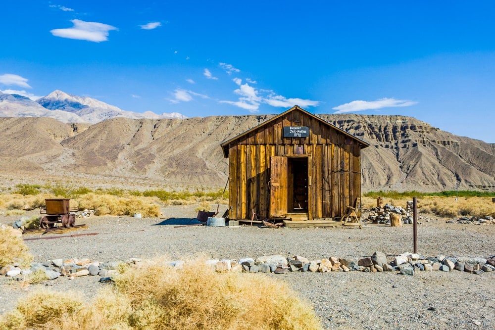
Pack plenty of water for this full-day hike. Death Valley is not only one of the lowest and driest places in America, but it is also one of the hottest places on Earth. On 10th July 1913, Furnace Creek Ranch in Death Valley registered a searing temperature of 56.7°C (134°F)!
The Valley is home to picture-perfect sand dunes, water-sculpted canyons, extinct volcanic craters and abandoned ghost towns such as Panamint City.
16. Denali National Park
State: Alaska
Hike: Savage Alpine Trail
Distance: 6.5km
Duration: 2-3 hours
Difficulty: Moderate
More info
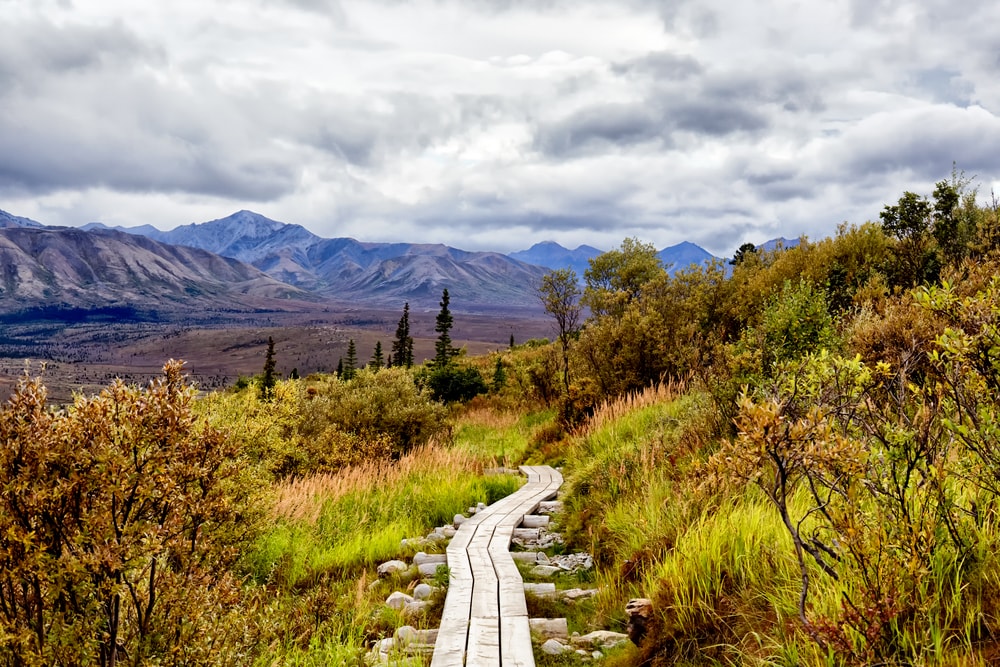
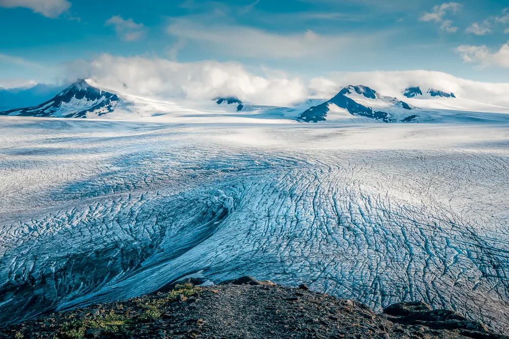
Denali National Park, a 24,500 sq km (9,460 sq mi) subarctic wilderness in Alaska, is home to the 20,300ft (6,190m) Denali – the tallest mountain in North America and one of the seven summits – as well as 40 named, and hundreds of unnamed, glaciers.
While you won’t get up close and personal to the iconic peak along this point-to-point trail, you will be spoilt by the panoramic views of six million acres of boreal forest, Arctic tundra and ice-capped mountains – an area larger than the state of Massachusetts.
17. Dry Tortugas National Park
State: Florida
Hike: Fort Jefferson Loop
Distance: 0.8 km
Duration: 0.5 hour
Difficulty: Easy
More info
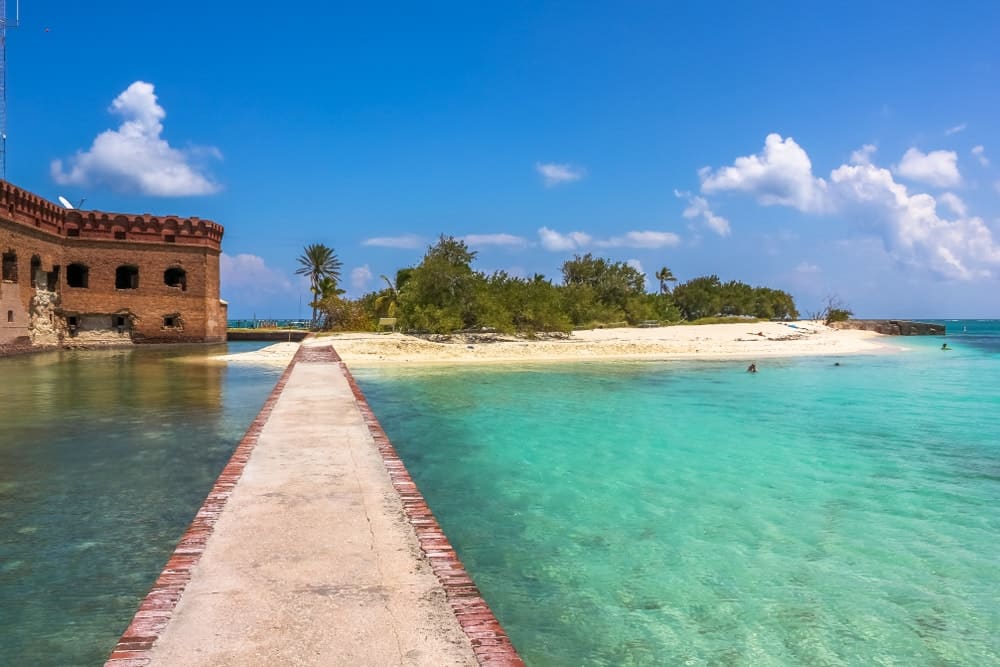
Lying 113km (70mi) west of Key West, the distinctive Dry Tortugas National Park includes seven islands in the Gulf of Mexico but is largely made up of open water. Only accessible by seaplane, the park is famed for its rare birds, historic military fort and aquamarine waters home to coral reefs and diverse marine life.
18. Everglades National Park
State: Florida
Hike: Snake Bight Trail
Distance: 5.8km
Duration: 1-2 hours
Difficulty: Easy
More info
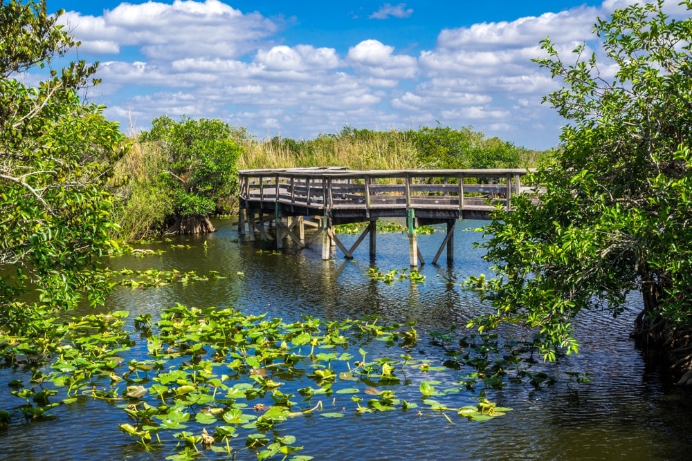
Known as the ‘River of Grass’ by Native Americans, the Everglades are an essential ecosystem for a multitude of rare and endangered species such as the American crocodile, manatee and the ever-elusive Florida panther.
Snake Bight Trail is a straightforward out-and-back boardwalk hike that culminates at a glorious viewpoint where you can spot pink flamingos along with myriad other bird species.
Alternative: Anhinga Trail, 1.3km, 0.5 hours
19. Gates of the Arctic National Park
State: Alaska
Hike: Arrigetch Peaks
Distance: 51.8km
Duration: 2-3 days
Difficulty: Hard
More info
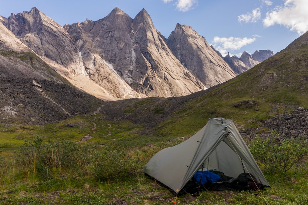
It’s hardly surprising that a vast hinterland such as the Gates of the Arctic – which doesn’t contain any roads or trails – is the least-visited US national park. Travellers to the remote region have to fly or hike into the park via the gateway communities of Bettles or Coldfoot via Fairbanks and backpack overnight to reach the awesome granite pinnacles of the Arrigetch Peaks. This is wilderness in its purest form.
20. Gateway Arch National Park
State: Missouri
Hike: Gateway Arch National Park Trail
Distance: 2.6km
Duration: 1 hour
Difficulty: Easy
More info

Minuscule Gateway Arch National Park contains America’s largest manmade monument, the eponymous Gateway Arch. Known as the ‘Gateway to the West’, the iconic memorial was erected in 1963 and is the tallest structure in Missouri.
Its purpose is threefold: to commemorate the Louisiana Purchase and the ensuing Westward Expansion of the USA during the 19th century; to celebrate the first civil government west of the Mississippi River; and to reflect upon the landmark 1857 Dred Scott v. Sandford case and the subsequent debate it raised over slavery.
21. Glacier National Park
State: Montana
Hike: Hidden Lake Trail
Distance: 8.5km
Duration: 2-3 hours
Difficulty: Moderate
More info
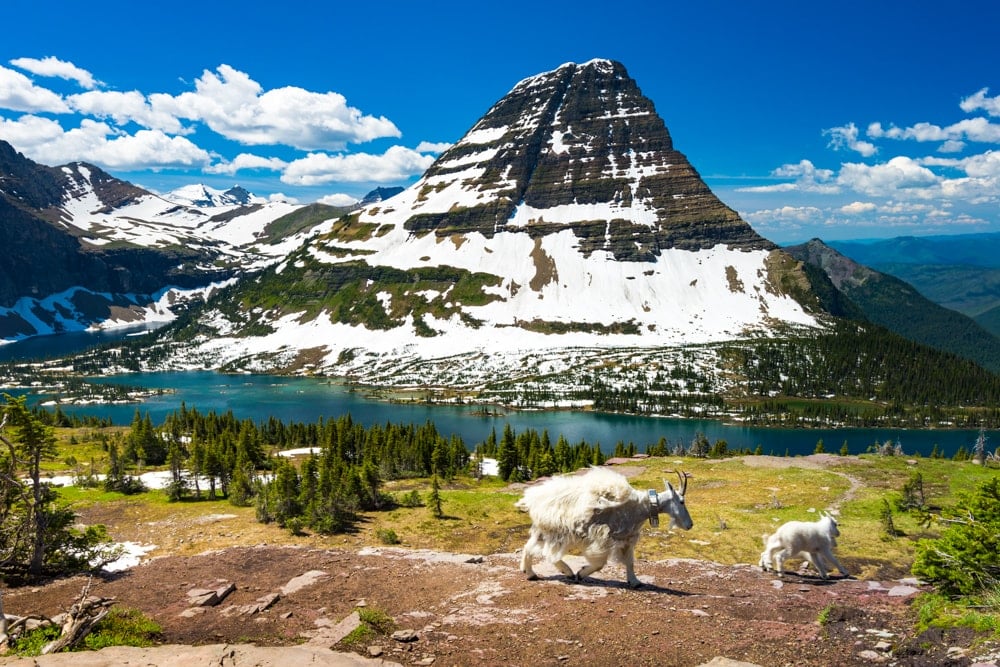
Receiving over three million recreational visits in 2021, Glacier is one of America’s favourite national parks and for good reason – the scenery is stunning. With towering snowcapped peaks, luxuriant forests, plummeting waterfalls and glassy aquamarine lakes, the park is a hiker’s paradise.
This out-and-back trail near Siyeh Bend is a popular walk, but don’t let that put you off. Even if you’re sharing the trail with another hiker or dozen, it’s worth the jostle. Keep your eyes peeled for grizzly bears.
22. Glacier Bay National Park
State: Alaska
Hike: Bartlett Lake and Towers Trail
Distance: 9.5km
Duration: 2-3 hours
Difficulty: Easy
More info
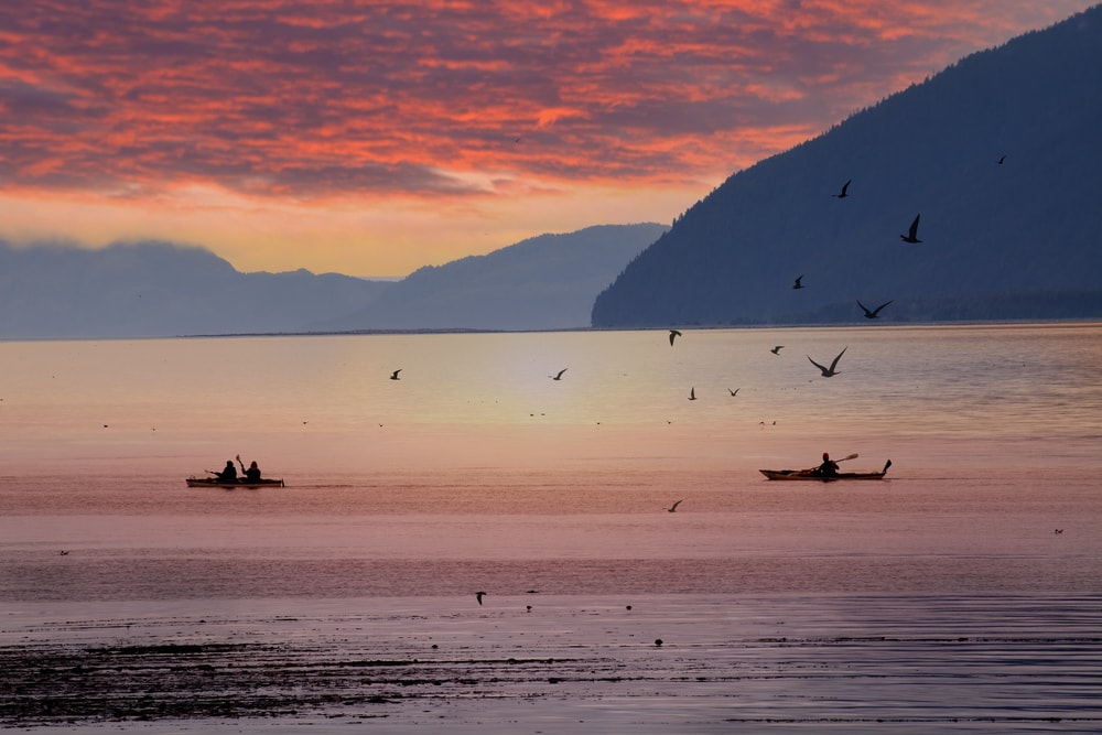
The most famous landscapes of the UNESCO-listed Glacier Bay National Park can only be accessed by private boat or as part of an Inside Passage cruise. For hikers, Bartlett Cove is the only developed area within Glacier Bay. There is a handful of short hikes around the area through forests and along shorelines.
23. Grand Canyon National Park
State: Arizona
Hike: Plateau Point Trail via Bright Angel Trail
Distance: 21.4km
Duration: 6-8 hours
Difficulty: Hard
More info
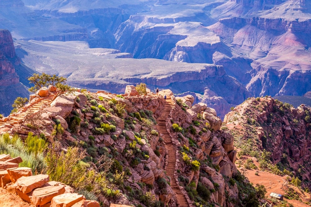
We can talk numbers – 446km (280mi) long, up to 29km (18mi) wide and 1.8km (1mi) deep – but nothing is quite as impressive as seeing this extraordinary gorge in real life.
Carved over millions of years by the Colorado River and its tributaries, the Grand Canyon exposes nearly two billion years of Earth’s geological history.
For thousands of years, the area was continuously inhabited by Native Americans who built settlements within the Canyon and its many caves. The first European known to have seen the Grand Canyon is García López de Cárdenas from Spain who arrived in 1540.
24. Grand Teton National Park
State: Wyoming
Hike: Jenny Lake Trail
Distance: 12.7km
Duration: 2-3 hours
Difficulty: Moderate
More info
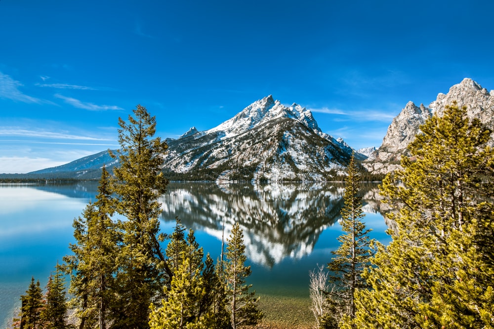
Grand Teton is another American favourite with its glorious wilderness, home to significant populations of bears, moose and elk. There are over 300km of hiking trails in the national park so it’s difficult to pick just one. This relatively moderate loop trail around one of Wyoming’s – America’s? – most well-known lakes may be popular but it is relentlessly sensational.
25. Great Basin National Park
State: Nevada
Hike: Bristlecone and Alpine Lakes Loop
Distance: 8.5km
Duration: 2-3 hours
Difficulty: Moderate
More info
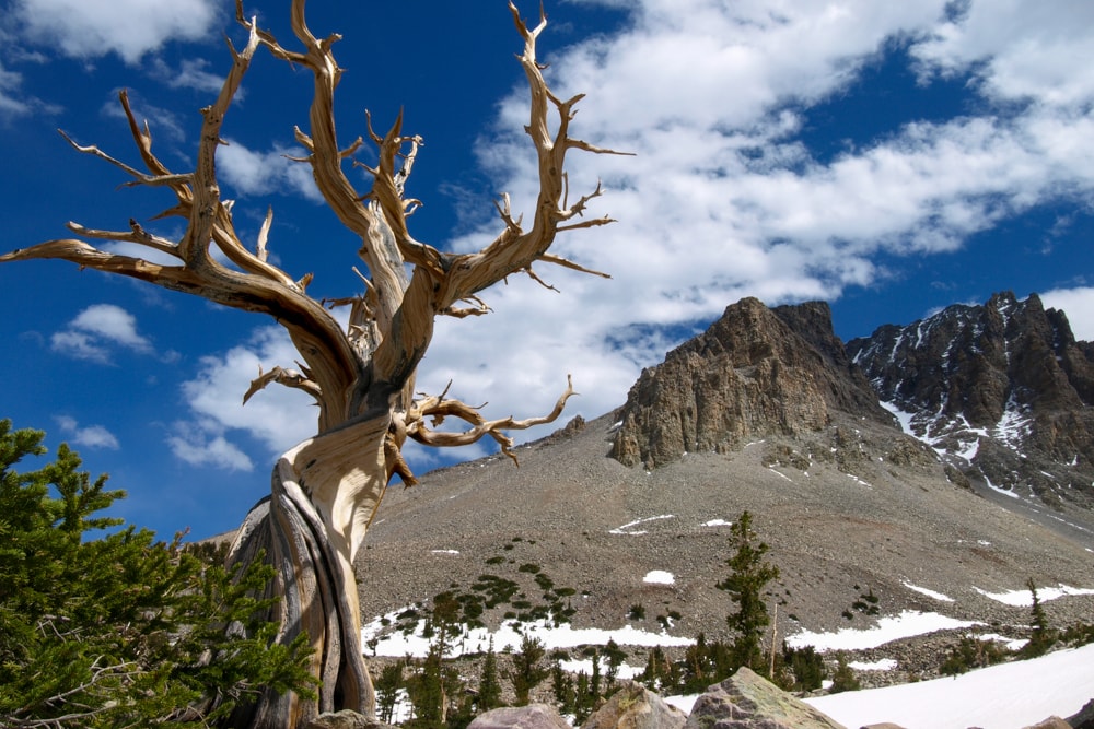
This loop trail near Baker takes in Nevada’s only glacier in the shadow of the stupendous Wheeler Peak in one of America’s least visited national parks. The high-altitude trail’s turnaround point is a remarkable sheet of ice in the bristlecone pine grove which features interpretive signs pinned to its ancient trees, some of which are believed to be over 5,000 years old.
26. Great Sand Dunes National Park
State: Colorado
Hike: High Dune Trail
Distance: 4.8km
Duration: 1-2 hours
Difficulty: Moderate
More info
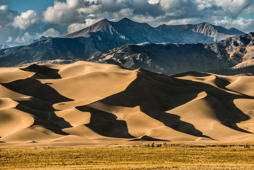
Great Sand Dunes National Park is home to North America’s tallest dunes as well as a diverse landscape of forest, grasslands, wetlands, alpine lakes and tundra. The out-and-back High Dune Trail is not really a trail at all as visitors can wander at will while they explore this surreal landscape.
27. Great Smoky Mountains National Park
State: North Carolina and Tennessee
Hike: Alum Cave Trail to Mount LeConte
Distance: 17.7km
Duration: 6-7 hours
Difficulty: Hard
More info
Known globally for its diversity of plant and animal life, the Great Smoky Mountains National Park straddles the border of North Carolina and Tennessee. This challenging out-and-back trail up to Alum Cave packs in the best of the Smokies into one tidy day hike. En route, you’ll discover gurgling waterfalls, an eerie rock tunnel and an overhanging cave which makes for an ideal lunch spot.
28. Guadalupe Mountains National Park
State: Texas
Hike: Guadalupe Peak Trail
Distance: 13.5km
Duration: 4-6 hours
Difficulty: Moderate-hard
More info
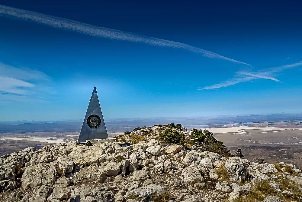
This out-and-back hike scrambles up to the 2,667m (8,751ft) ‘top of Texas’ where summiteers can gape out across the enormous Chihuahuan Desert. During the hike, you’ll spot soaring conifers, sheer rock cliffs and a one-of-kind summit marker.
29. Haleakalā National Park
State: Hawaii
Hike: Sliding Sands Trail (and Kapalaoa Cabin)
Distance: 18.5km
Duration: 5-7 hours
Difficulty: Hard
More info

This is probably not the landscape that springs to mind when you think of Hawaii. This tough out-and-back trail in Haleakalā National Park traverses what can only be described as an alien landscape. The extraordinary foot journey takes in dormant cinder cones and endangered Hawaiian silversword plants. The colours really come alive at sunset and sunrise.
30. Hawaii Volcanoes National Park
State: Hawaii
Hike: Napau Crater via Napau Trail
Distance: 19km
Duration: 4-6 hours
Difficulty: Hard
More info
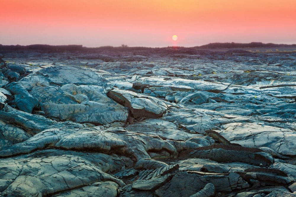
From the ridges of Napau Crater, you’ll see the verdant landscape of rainforests and meadows one might expect to see when in Hawaii. But once on the crater floor, that all changes. Instead, hikers are met with a surreal volcano-induced desert. On the horizon, you’ll spot the Puu Oo volcano, which near-continuously erupted from 1983 to 2018.
31. Hot Springs National Park
State: Arkansas
Hike: Hot Springs Mountain Trail
Distance: 5.3km
Duration: 1-2 hours
Difficulty: Easy
More info
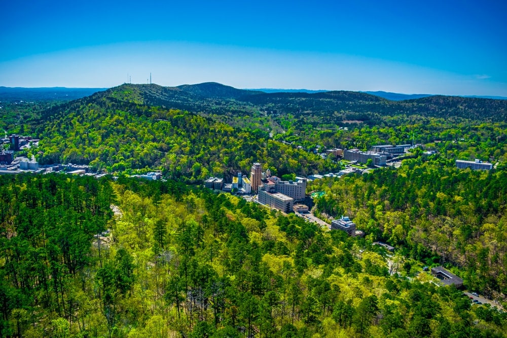
While Hot Springs is more commonly known for its curative waters than its hiking, there are some worthy walks nestled in the surrounding hills. This easy loop trail boasts great views of the Ouachita Mountains and just about works up enough sweat to earn you a soak in the springs when you get back into town.
32. Indiana Dunes National Park
State: Indiana
Hike: West Beach Three-Loop Trail
Distance: 5.6km
Duration: 1-2 hours
Difficulty: Easy
More info
In 2019, Indiana Dunes on the southern shore of Lake Michigan became America’s 61st national park. This peaceful part of Indiana is home to cheerful sandy beaches, sunny prairies, slow-moving rivers and tranquil forests. It is also rich in biodiversity with over 2,000 species of plants and birds.
33. Isle Royale National Park
State: Michigan
Hike: Greenstone Ridge Trail
Distance: 63.6km
Duration: 2-3 days
Difficulty: Moderate-hard
More info
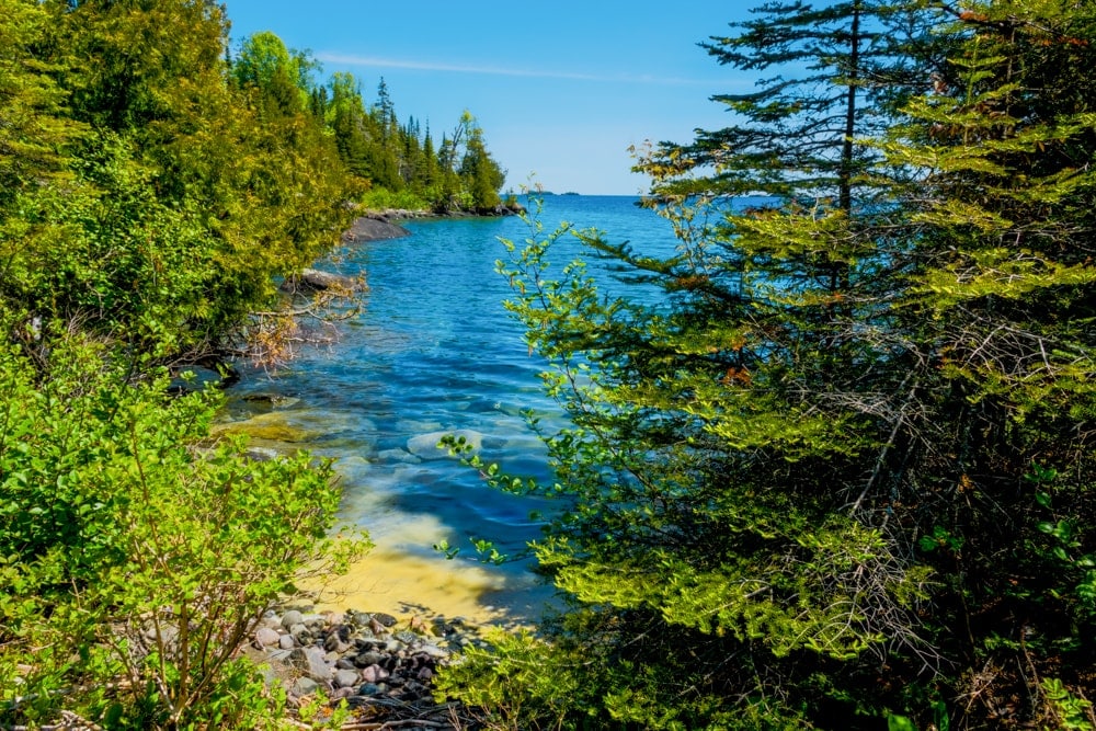
Located in the middle of Michigan’s Lake Superior, Isle Royale, which can only be reached by ferry and seaplane, has a diverse array of activities on offer including hiking, trekking, camping, boating, sailing, paddling and even scuba diving. Other draws include over 2,000 moose who call the island home, some of the best-preserved shipwrecks in the US and the Greenstone Ridge Trail that crosses the summit of Mount Desor which, at 425m (1,394ft), is the park’s highest point.
Alternative: Cowles Bog Trail, 6.9km, 1-2 hours
34. Joshua Tree National Park
State: California
Hike: Maze Loop
Distance: 7.9km
Duration: 2 hours
Difficulty: Easy-moderate
More info
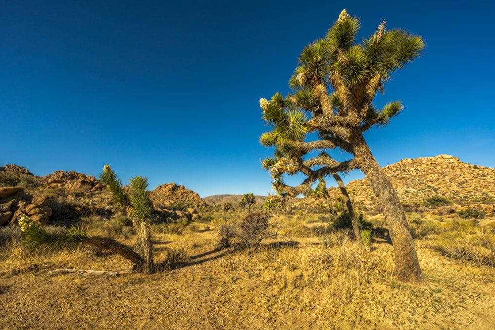
Known for its iconic and whimsical trees, Joshua is positioned at the transition zone of two deserts: low-lying arid Colorado and higher, muggier and cooler Mojave. This relatively easy-going circular trail passes desert vegetation such as the California juniper, yucca and, of course, the park’s eponymous Joshua trees.
35. Katmai National Park
State: Alaska
Hike: Brooks Lodge, Brooks River Bridge, Riffles Platform and Brooks Falls
Distance: 5km
Duration: 1-2 hours
Difficulty: Easy
More info
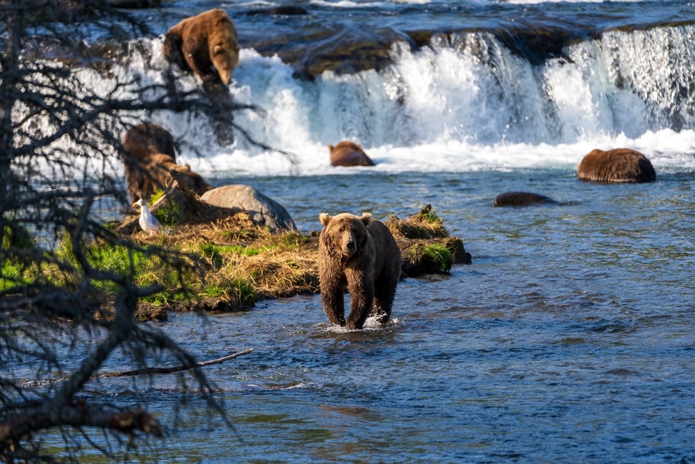
Unconnected by road to any town, Katmai has earned a reputation as Alaska’s premier wildlife-viewing destination, with bear watching at Brooks Camp the most popular. The park is an important habitat for salmon, hence the thousands of brown bears that flock to the cold, clear water of the Brooks River to feast on the abundant fish every summer. Other activities include fishing, hiking, rafting and kayaking.
36. Kenai Fjords National Park
State: Alaska
Hike: Harding Icefield Trail
Distance: 13.2km
Duration: 6-7 hours
Difficulty: Hard
More info
‘Epic’ is the word that springs to mind when you first glimpse the Harding Icefield of Kenai Fjords National Park. Nearly 40 glaciers flow from the immense expanse of ice while diverse wildlife teems in the icy waters and lush forests that encircle it. This tough out-and-back trail near Seward begins on the valley floor and winds through cottonwoods and alder trees before climbing above the treeline for spectacular views of the ice.
37. Kings Canyon National Park
State: California
Hike: Mist Falls
Distance: 14km
Duration: 3-4 hours
Difficulty: Moderate
More info
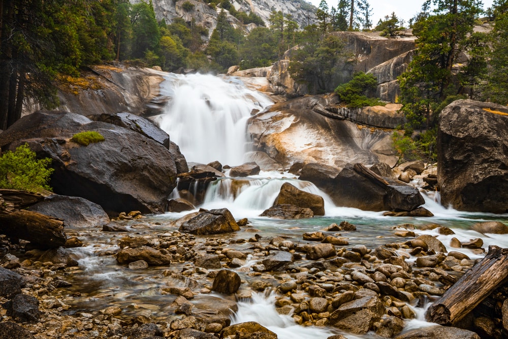
Deeper than the Grand Canyon, the rugged glacier-carved valley of Kings Canyon plunges over 1,600m (5250ft) down to a series of fast-flowing rivers and cascades. Within its perimeters is General Grant, the second-largest known tree in the world. The hike we’ve selected is the out-and-back trail to Mist Falls which passes the enormous 2,787m (9,143ft) granite face of The Sphynx and old-growth Sequoia forests en route to the 14m (45ft) waterfalls.
38. Kobuk Valley National Park
State: Alaska
Hike: Great Kobuk Sand Dunes
Distance: Flexible
Duration: Flexible
Difficulty: Moderate
More info
Apart from its Arctic sand dunes, Kobuk Valley is known for its breathtaking caribou migrations that see over 500,000 of the magnificent beasts travel more than 1,500km (930mi) north during spring to reach their calving grounds before repeating the feat in autumn and returning south. There are no roads, so access is via small plane only. Once on the ground, there are marked routes but sound backcountry skills are still essential.
39. Lake Clark National Park
State: Alaska
Hike: Kontrashibuna Lake via Tanalian Falls Trail
Distance: 10.5km
Duration: 2-4 hours
Difficulty: Moderate
More info
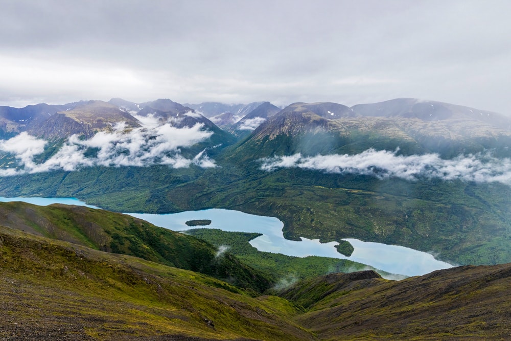
The trailhead for Kontrashibuna Lake is located in Port Alsworth making this an accessible and deeply rewarding hike for somewhere so remote. Lake Clark may be Alaska’s most diverse national park in terms of topography and ecosystems. It’s possible to hike among tundra-carpeted hills, craggy peaks, immense glaciers, two active volcanoes and a dramatic coastline. Naturally, the rich landscape is home to a variety of wildlife including bears, seabirds and the world’s largest sockeye salmon fishery.
40. Lassen Volcanic National Park
State: California
Hike: Lassen Peak
Distance: 8.2km
Duration: 3-4 hours
Difficulty: Hard
More info
Home to steaming fumaroles, mud pools, sulfur vents, multicoloured cones and crater lakes, Lassen Volcanic National Park is one of the few areas in the world where all four types of volcano – cinder cone, plug dome, shield and stratovolcano – can be seen.
Lassen Peak dominates the park, so we’ve picked out a challenging out-and-back trail to its 3,187m (10,457ft) summit. From its apex, you can see the mineral-green Helen Lake, the distinctive mound of Cinder Cone and the Devastated Area, a remnant of the volcano’s eruptions in the early 20th century.
41. Mammoth Cave National Park
State: Kentucky
Hike: Extended Historic Tour
Distance: 3.2 km
Duration: 2-3 hours
Difficulty: Easy
More info
Home to the longest known cave system on earth, Mammoth Cave National Park has more than 650km of surveyed tunnels including a cavern big enough to hold a 737 airplane. You can only explore the cave on a ranger-led or a short self-guided cave tour. We think the Extended Historic Tour is the best option as it covers all the main sites.
42. Mesa Verde National Park
State: Colorado
Hike: Petroglyph Point Trail (via Cliff Palace)
Distance: 3.9km
Duration: 1-2 hours
Difficulty: Easy
More info
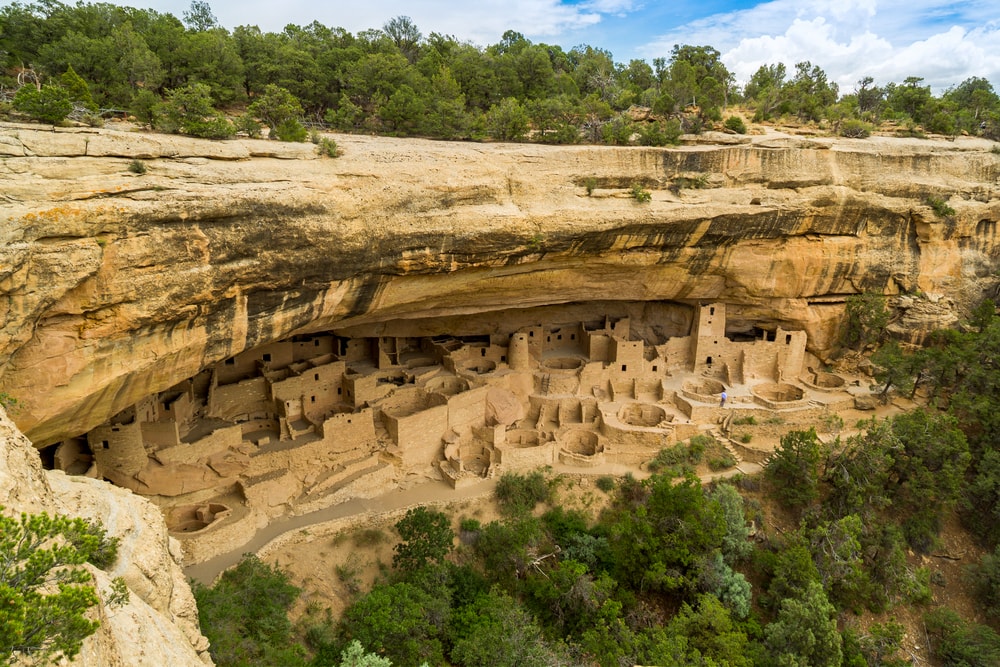
With more than 4,300 sites, including 600 cliff dwellings, Mesa Verde National Park is the largest archaeological preserve in the US.
Its best-known ruin, Cliff Palace, is constructed of sandstone, wooden beams and mortar, and dates back more than 700 years. It was home to approximately 125 people but was likely an important part of a larger community of 60 nearby pueblos housing a total of 600 or more people. With 23 kivas and 150 rooms, the multi-storey Cliff Palace is thought to be the largest cliff dwelling in North America.
43. Mount Rainier National Park
State: Washington
Hike: High Lakes Loop
Distance: 5.1 km
Duration: 1-2 hours
Difficulty: Easy-moderate
More info
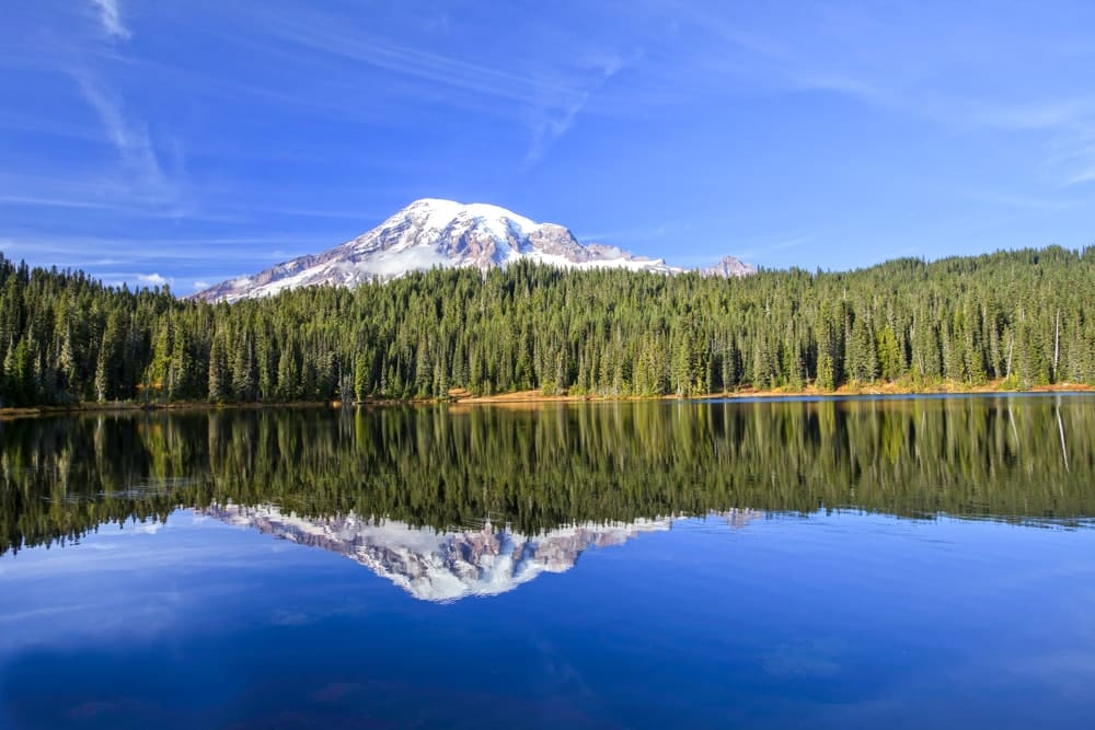
Mount Rainier, one of America’s most beautiful mountains, is the highest peak in Washington State as well as the Cascade Range. It is the most glaciated peak in the contiguous US and spawns five major rivers from its icy slopes. The mountain is frequently used as training for Denali as it shares many of the characteristics and challenges found on the continent’s highest peak.
While the High Lakes Trail doesn’t provide a completely unobstructed view of Mount Rainier, it does include the Lower Lakes Trail and the Wonderland Trail which takes you along Reflection Lake where Rainier shimmers on its surface.
44. National Park of American Samoa
State: American Samoa
Hike: Mount ‘Alava Trail
Distance: 9.8 km
Duration: 2-4 hours
Difficulty: Moderate
More info
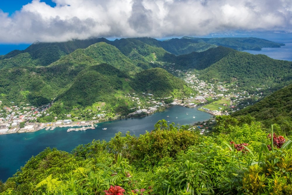
American Samoa, an unincorporated territory of the US located in the South Pacific Ocean, has just one national park that protects swathes of virtually pristine landscape across three islands and 33 sq km of ocean. The trail begins near Pago Pago, the territory’s capital, and after an initial climb largely follows the arching ridgeline of the surrounding forested hills. Expect abundant birdlife and glorious coastline views throughout.
45. New River Gorge National Park
State: West Virginia
Hike: Long Point Trail
Distance: 4.2km
Duration: 1-2 hours
Difficulty: Easy
More info
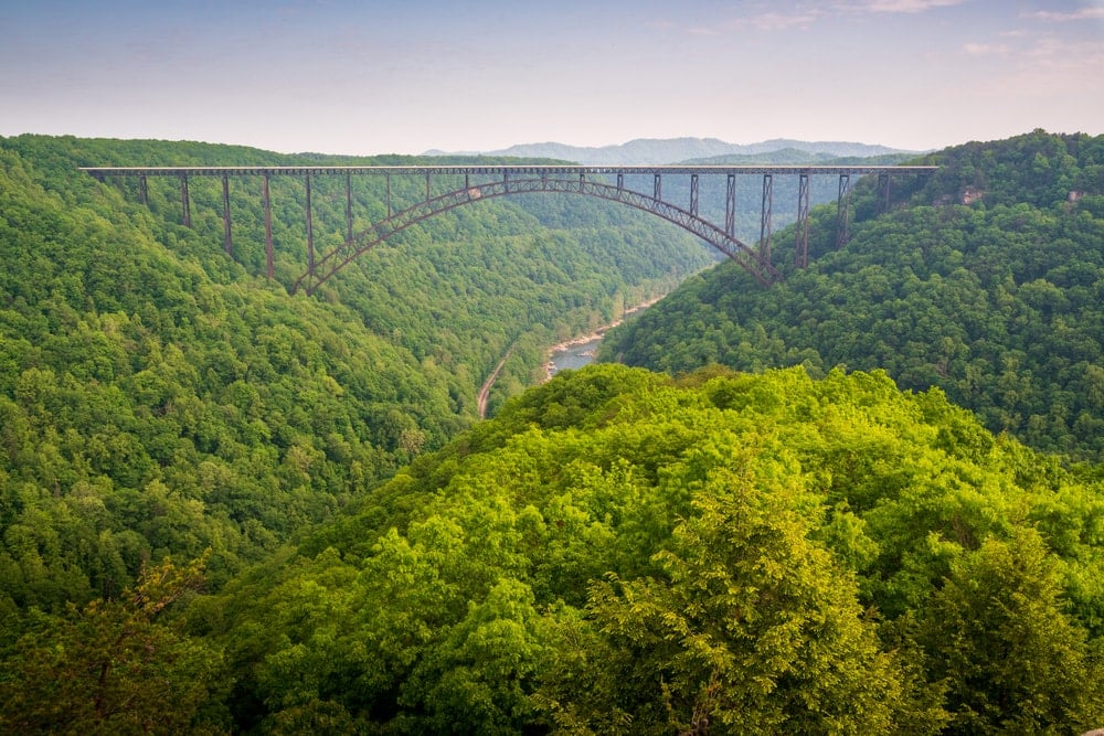
New River Gorge in the Appalachian Mountains is not the most exciting national park in the US. In fact, the most notable feature of the park is probably its 924m (3,030ft) steel arch bridge. That said, the whitewater river coursing through deep canyons and folds of forest-carpeted mountains will always be good for the mind and soul. The out-and-back Long Point Trail gets you up to the park’s best lookout which overlooks the gorge, the river, and, of course, that bridge.
46. North Cascades National Park
State: Washington
Hike: Thunder Creek and Park Creek Trails
Distance: 31.5km and 13km
Duration: 1-2 days
Difficulty: Moderate-hard
More info
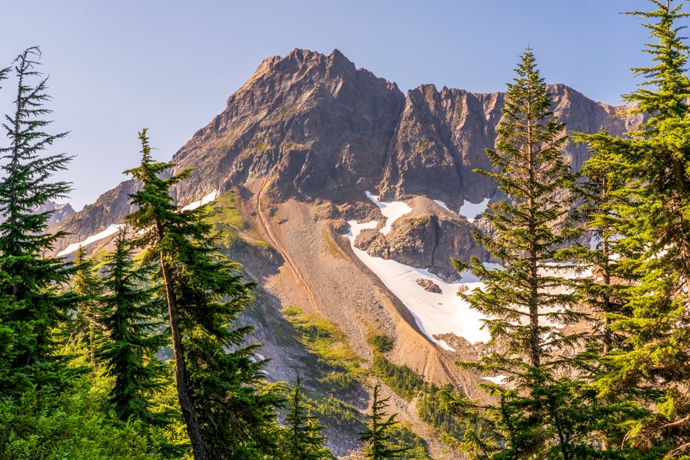
Even though the North Cascades National Park is just three hours from Seattle, somehow the park receives just a trickle of visitors compared with other protected areas in the Northwest. Names such as Mount Terror, Mount Fury and Mount Despair may put off some visitors, but it’s more likely the park’s inaccessibility. It has just one road slicing through its landscape of jagged peaks and verdant valleys, home to 300-plus glaciers.
Alternative: Cascade Pass Trail, 10.8km, 2-3 hours
47. Olympic National Park
State: Washington
Hike: Hole-in-the-Wall from Rialto Beach
Distance: 5.3km
Duration: 1-2 hours
Difficulty: Easy
More info
Olympic National Park encompasses an old-growth temperate rainforest, glacier-capped peaks and over 90km of rugged Pacific coastline. It’s also largely roadless making it ripe for wilderness tramping. If you don’t fancy trailblazing through the interior, then the iconic craggy coastal walk from Rialto Beach to the Hole-in-the-Wall never fails to enthral.
48. Petrified Forest National Park
State: Arizona
Hike: Blue Mesa Trail
Distance: 1.6km
Duration: 0.5 hours
Difficulty: Easy
More info
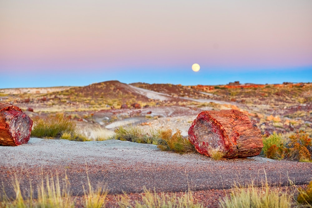
Petrified Forest National Park is so named because of its large deposits of petrified wood, remnants of tall conifers which grew 225 million years ago – around the time of the first dinosaurs!
Some of the fossilised logs are huge – up to 6ft (2m) in diameter – and at least one spans a ravine to form a natural bridge. The fossils are made up of almost solid quartz. Each piece is like a giant crystal with a rainbow of colours created by impurities such as iron, carbon and manganese.
49. Pinnacles National Park
State: California
Hike: Condor Gulch Trail to High Peaks Trail Loop
Distance: 8.9km
Duration: 2-4 hours
Difficulty: Moderate-hard
More info
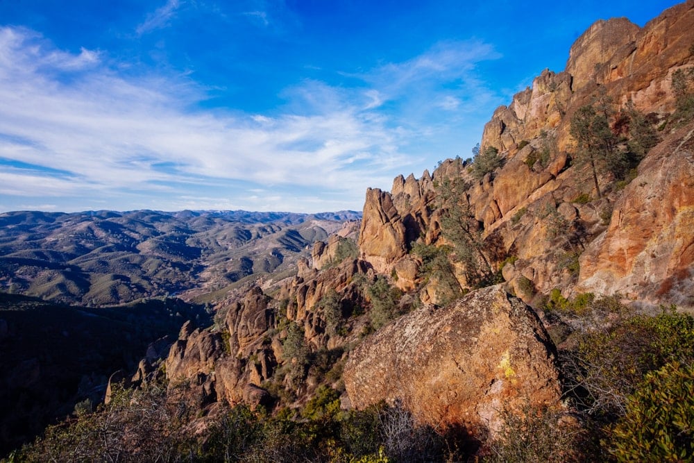
Pinnacles was designated a US national park in 2013 due in part to its condor recovery program. It is not as regularly trekked as many parks on this list which is one of the best reasons to visit.
Enjoy hundreds of crowd-free rock-climbing routes and journey through chaparral, oak woodlands and canyon bottoms. Visitors can also explore rare talus caves (watch out for bats!) and emerge to towering rock spires teeming with life: prairie and peregrine falcons, golden eagles and, of course, the Californian condor.
50. Redwood National Park
State: California
Hike: Tall Trees Grove Loop Trail
Distance: 5.8km
Duration: 1-2 hours
Difficulty: Moderate
More info
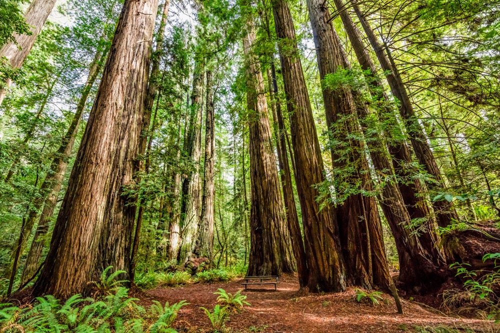
Giant Redwoods is home to some of the world’s tallest and most ancient trees as well as prairies, wild rivers and 65km of glorious Californian coastline. There are scores of trails to explore but arguably the most iconic is the remote trail to Tall Trees Grove. Its popularity means that visitors planning to go must apply for a free permit. These are limited to 50 groups per day and are issued up to 24 hours in advance.
51. Rocky Mountain National Park
State: Colorado
Hike: Mills Lake
Distance: 8km (option to add 2.7km to Black Lake)
Duration: 2-3 hours
Difficulty: Moderate-hard
More info
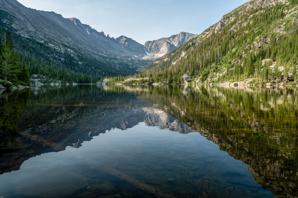
Receiving over 4.4 million recreational visits in 2021, mighty Rocky Mountain is America’s fourth most-popular national park and is often cited as the crown jewel of Colorado’s national parks. It is outrageously beautiful. So much so, it’s difficult to know where to begin. If you’re a first-time visitor, we suggest opting for this classic out-and-back hike to Mills Lake with the option to extend to Black Lake.
52. Saguaro National Park
State: Arizona
Hike: Wasson Peak via King Canyon and Hugh Norris Trail
Distance: 12.7km
Duration: 3-4 hours
Difficulty: Moderate
More info
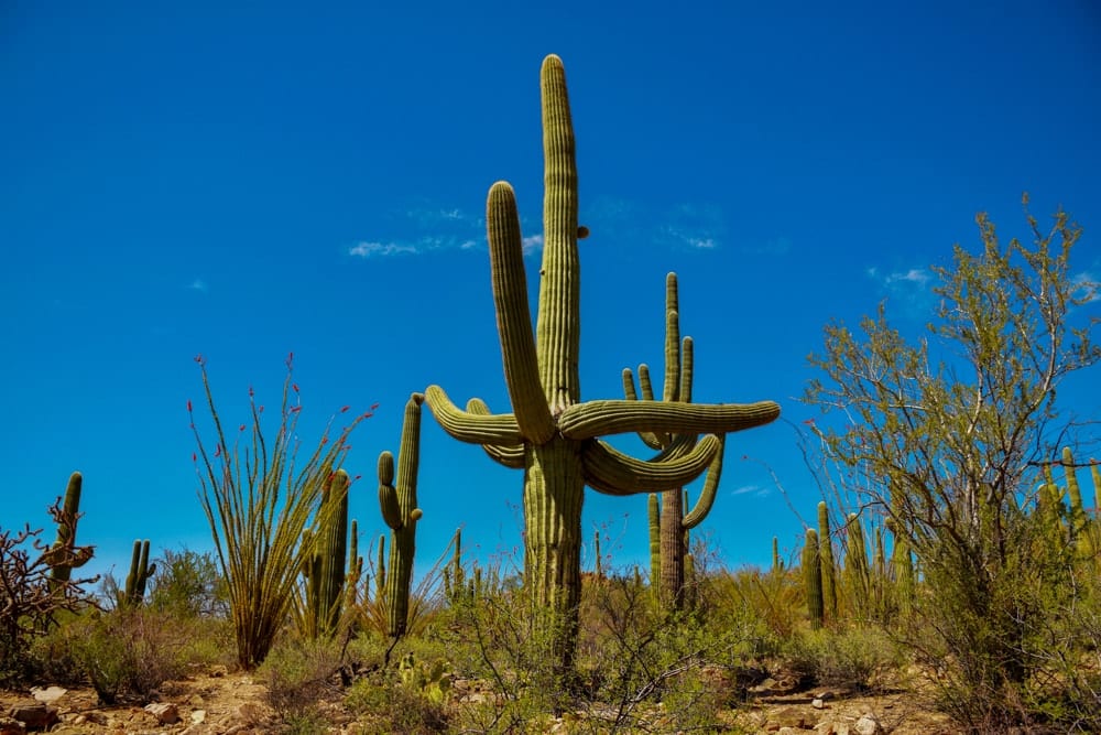
The tree-like cactus species of Saguaros are icons of the American Southwest. This loop trail passes through the bizarre desert landscape, incorporating a mountain summit, petroglyphs, sweeping views of Tucson and thousands of Saguaro’s namesake cacti along the way.
53. Sequoia National Park
State: California
Hike: Mount Whitney Trail
Distance: 34km
Duration: 2-3 days
Difficulty: Hard
More info
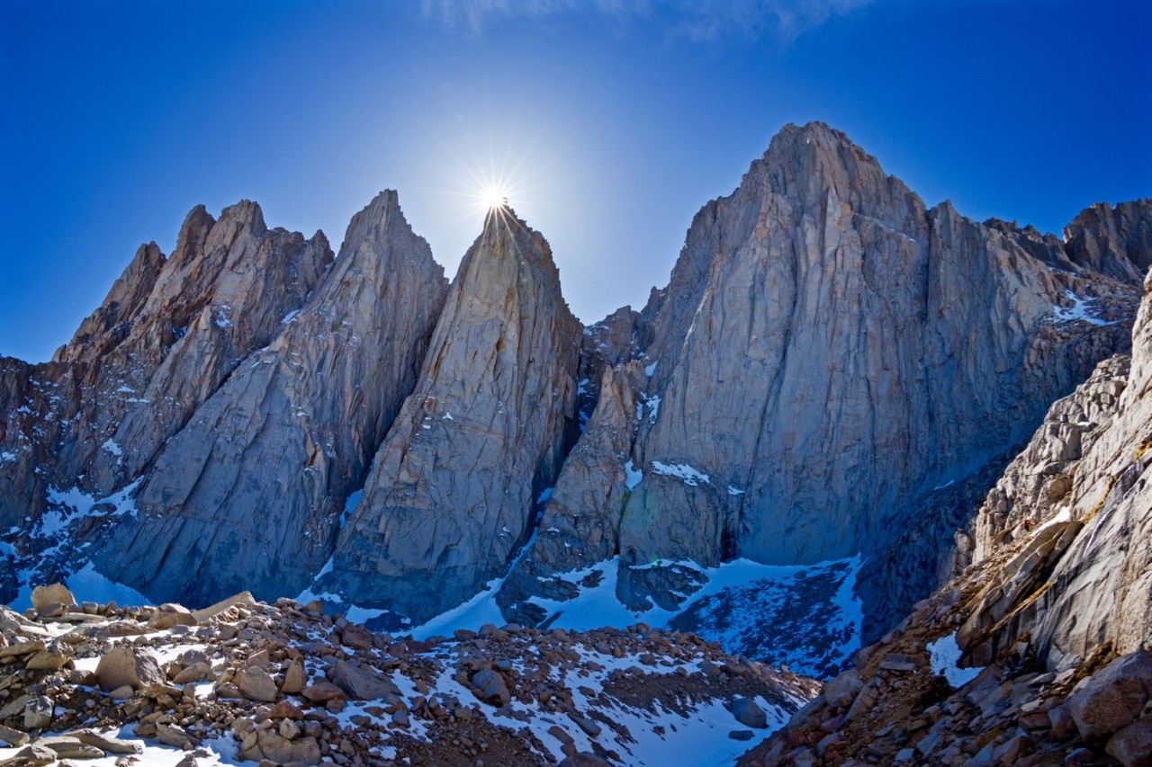
Mount Whitney is the highest summit in the contiguous USA (i.e. excluding Hawaii and Alaska). While its serrated ridges may look intimidating at first sight, it’s a relatively straightforward ascent and can be achieved by those with limited mountaineering experience.
The popular Mount Whitney Trail starts at an elevation of 2,550m (8,360ft), meaning that the summit can be reached in just a day. However, most hikers prefer to take at least two days to complete the 35km round trip with an elevation gain of just over 1,900m (6,100ft).
Alternatives: Lakes Trail, 18.7km, 5-7 hours or High Sierra Trail. 116km, 7-10 days
54. Shenandoah National Park
State: Virginia
Hike: Doyles River Loop via Appalachian Trail
Distance: 14.5km
Duration: 3-4 hours
Difficulty: Moderate
More info
The AT is probably the most famous of America’s Triple Crown of long-distance hiking trails (Appalachian, Pacific Crest and Continental Divide). The 3,500km trail passes through no fewer than 14 states, eight national forests and two national parks including Shenandoah.
The popular Doyles River Loop takes in part of the iconic trail as it weaves through dense, leafy woodland and past cool, crisp mountain streams and two dramatic waterfalls.
55. Theodore Roosevelt National Park
State: North Dakota
Hike: Maah Daah Hey Trail
Distance: 229km
Duration: 7-10 days
Difficulty: Hard
More info and here
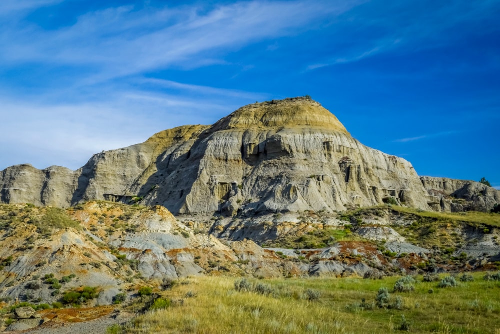
North Dakota, the fourth least populous state, is home to the badlands of Theodore Roosevelt National Park. There’s not a lot of human activity on the rolling prairies, and mounds of striated earth make the long and remote Maah Daah Hey Trail a real test of physical and mental endurance.
Alternative: Caprock Coulee Loop, 7.1km, 2 hours
56. Virgin Islands National Park
State: US Virgin Islands
Hike: Reef Bay Trail
Distance: 7.1km
Duration: 2-3 hours
Difficulty: Moderate
More info
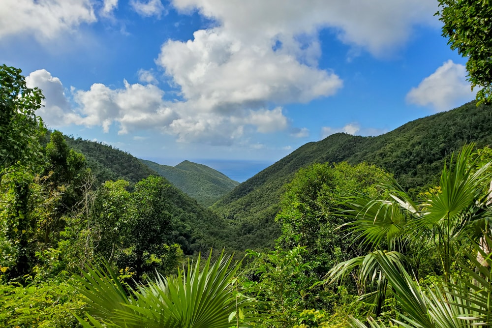
St John is the smallest of the three main islands of the unincorporated territory of the US Virgin Islands. Two-thirds of the island is covered by the Virgin Islands National Park which includes swathes of stunning white-sand shores, pristine reefs and 26 hiking trails. The out-and-back Reef Bay Trail begins in the dense lush interior and descends 250m to the idyllic Reef Bay Beach. Here, you can while a few hours frolicking in the surf before heading back the way you came.
57. Voyageurs National Park
State: Minnesota
Hike: Blind Ash Bay Trail
Distance: 4.8km
Duration: 1-2hours
Difficulty: Easy
More info
On the US-Canada border in Minnesota sits the 218,000-acre wetlands of Voyageurs National Park. Nearly half of the park is water which turns to ice during the colder months. As such, it’s often easier to explore the lakes on foot when it’s frozen as the waters are regularly too choppy for canoes or kayaks. The land is filled with dense forests and wetlands contained by ragged cliffs and rocky ridges.
58. White Sands National Park
State: New Mexico Dakota
Hike: Dune Life Nature Trail
Distance: 1.6km
Duration: 0.5 hours
Difficulty: Easy
More info
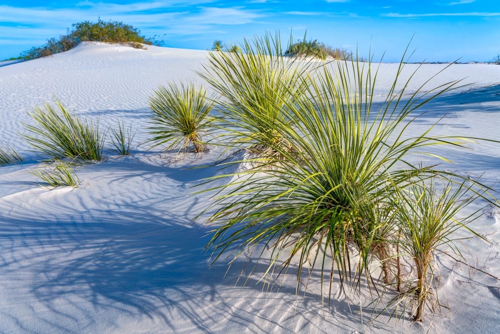
Rising from the heart of the Tularosa Basin, the blinding white sands of New Mexico stretch over 712 sq km (275 sq mi) of desert, creating the world’s largest gypsum dune field and one of the most surreal scenes in the States, if not the world. White Sands National Park is a highlight of any trip to New Mexico, particularly if you time your visit with sunrise or sunset.
59. WIND CAVE NATIONAL PARK
State: South Dakota
Hike: Lookout Point and Centennial Trail Loop
Distance: 8.4km
Duration: 1-2 hours
Difficulty: Easy
More info
Wind Cave, and its boxwork rock formations beneath the Black Hills of South Dakota, is one of the world’s most complex cave systems. However, while the caves are fascinating, the best hiking is found above ground among the prairies and forests where the bison rove.
Alternative: Rankin Ridge Nature Trail, 1.6km, 0.5 hours
60. Wrangell–St. Elias National Park
State: Alaska
Hike: Root Glacier Trail
Distance: 9.2km
Duration: 2-3 hours
Difficulty: Hard
More info
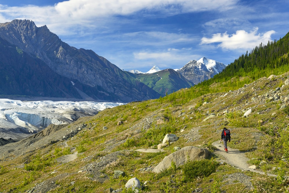
Finding a trail to yourself in Wrangell-St Elias won’t be a problem. America’s largest national park, at 53,320 sq km, is the same size as Yellowstone, Yosemite and Switzerland combined!
The park is also home to Mount Saint Elias, one of the most beautiful mountains in the US. This out-and-back trail near McCarthy is relatively accessible considering the park’s remote location.
61. Yellowstone National Park
State: Wyoming, Montana and Idaho
Hike: Fairy Creek Trail to Imperial Geyser
Distance: 10.5km
Duration: 2-3 hours
Difficulty: Easy
More info
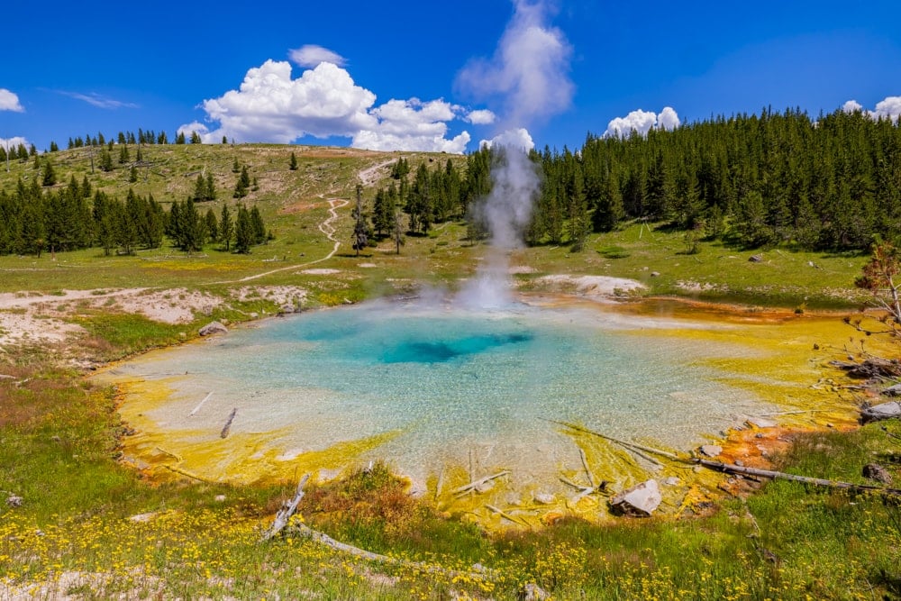
This out-and-back trail to Imperial Geyser is a pocket slideshow of Yellowstone. You’ll get a view of the largest hot spring in the US (and the world’s third largest) from the Grand Prismatic Spring Overlook. You’ll also visit Fairy Falls, Yellowstone’s most spectacular waterfalls, and have the chance to spot bison roaming the plains.
62. Yosemite National Park
State: California
Hike: Valley Loop Trail
Distance: 32.7km
Duration: 7-8 hours
Difficulty: Moderate
More info
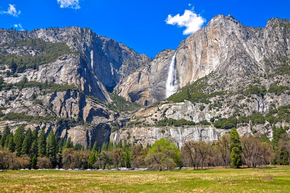
It’s practically impossible to find a trail to yourself in Yosemite but the Valley Loop Trail is one of the quieter routes in the park. The trail follows old wagon roads through the valley’s meadows with views of El Capitan and the falls never far from view.
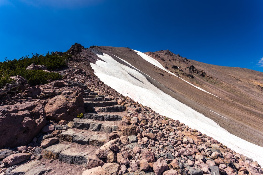
63. Zion National Park
State: Utah
Hike: Observation Point via East Mesa Trail
Distance: 11.3km
Duration: 2-3 hours
Difficulty: Moderate
More info
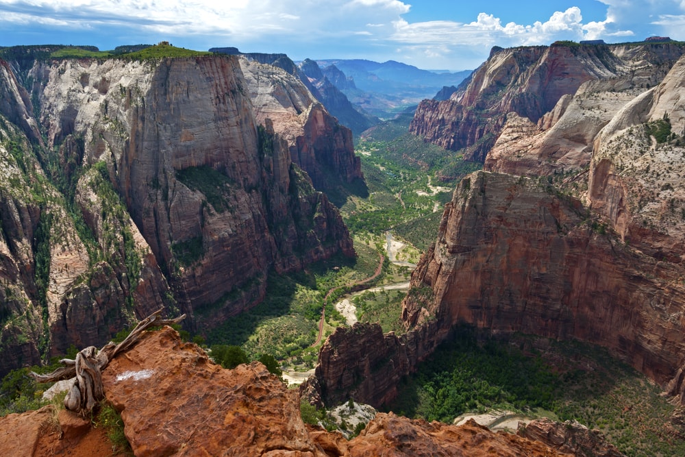
Utah’s first national park, and America’s second most popular, needs no introduction. The sandstone cliffs of Zion are synonymous with the American outdoors and Observation Point is one of the park’s most famous viewpoints. This is a popular trail and for good reason – the view is sensational. The route can be easily adapted or combined with other trails in the region.
The Observation Point Trail is prone to rockfalls so always check the NPS website first for the latest updates.
Enjoyed this post? pin it for later…
Lead image: zijin/Shutterstock
[flexi-common-toolbar] [flexi-form class=”flexi_form_style” title=”Submit to Flexi” name=”my_form” ajax=”true”][flexi-form-tag type=”post_title” class=”fl-input” title=”Title” value=”” required=”true”][flexi-form-tag type=”category” title=”Select category”][flexi-form-tag type=”tag” title=”Insert tag”][flexi-form-tag type=”article” class=”fl-textarea” title=”Description” ][flexi-form-tag type=”file” title=”Select file” required=”true”][flexi-form-tag type=”submit” name=”submit” value=”Submit Now”] [/flexi-form]


Tagged: travel blog, Uncategorised